Town

Walsall

Walsall's leather trades grew beside an older metalworking economy. Workshops, hospitals, parkland and a canal-side gallery show how work and civic life developed together.

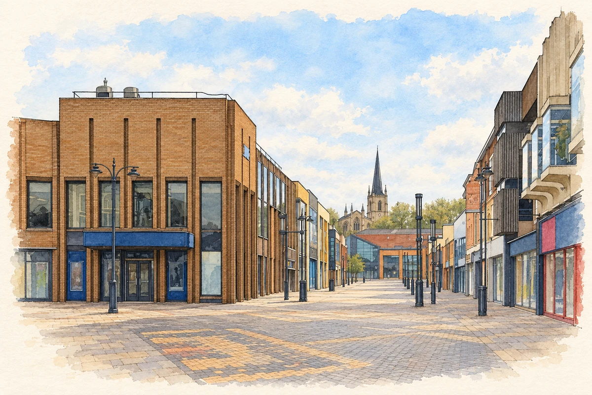
Watercolour and fine ink illustration of Walsall town centre
Illustration · Walsall town centre
History & heritage

Place & story

A market town with industrial resources

Walsall's market economy was long rooted in agriculture, but local coal, ironstone and limestone also supported metalworking. Makers of horse fittings produced bits, stirrups, buckles and spurs. This trade, known as lorinery, supplied the components that helped leatherworking take root. Saddlery was therefore part of an interconnected economy of metal and leather skills. [2]

Canals and railways gave foundries, mines and ironworks access to wider markets. Limestone extraction left an enduring physical consequence: subsidence beneath parts of the town. Some flooded quarries also became the lakes of the Arboretum. Opened in 1874, the park became free to enter in 1885, turning part of an extractive landscape into a shared amenity. [2]

The horse economy and its workforce

Leatherworking expanded rapidly after 1840. Bridlecutters could obtain bits and buckles from local loriners, while the railway's arrival in 1847 helped the trade. The Leather Museum records seventy-five firms making bridles, saddles and harness by 1851. Victorian reliance on horses created a large market, and overseas and military orders extended the reach of Walsall's workshops. [3]

Commercial success coexisted with insecure conditions. The museum's history describes many small backyard workshops and reports the 1889 Sweated Trades Commission's concerns about low wages and long hours. Women commonly earned far less than men, were paid by the item and could lose work without pay when orders fell. Employers could even deduct charges for lighting, heat and workspace. [3]

Motor transport gradually reduced demand for harness and saddlery. Firms turned increasingly to bags, wallets and other lighter goods, some already made since the 1870s. Later overseas competition encouraged specialisation in luxury products, while recreational riding helped revive saddlery and bridle manufacture. Adaptation, rather than a single unbroken boom, shaped the industry's survival. [3]

An industrial town needs nursing

Industrial accidents connected medical care closely with railway and factory work. Sister Dora served at successive small hospitals in Walsall. Railwaymen raised money to give her a pony and carriage in 1873 so she could reach housebound patients. That gift reveals a relationship of practical mutual support between a nurse and working people, rather than care flowing in only one direction. [4]

During the 1875 smallpox epidemic she spent six months working at a separate epidemic hospital. Her local commemoration subsequently included the hospital's name, a public statue and railway locomotives bearing her name, linking medical service with the town's public memory. [4]

From carrying freight to welcoming visitors

The Walsall Canal connected Ryders Green Junction with the Town Wharf. Its commercial life lasted into the 1960s: the Canal & River Trust records Thomas Clayton's last crude-tar journey from Walsall Gasworks in 1966. Branch abandonments reduced the network, while refurbishment later provided moorings for visitors near the new art gallery. The same waterside acquired a different public purpose. [5]

Art at the former wharf

Kathleen Garman's gift of the Garman Ryan Collection in 1973 gave Walsall a major public art resource. Developed with sculptor Sally Ryan, it brought work from many cultures into a collection formerly associated with private domestic life. Its initial home was the old Museum and Art Gallery in Lichfield Street. The need for more space helped drive the creation of a new gallery, opened in February 2000. [6]

Architects Caruso St John placed the new gallery on a former industrial wharf. They describe a tower responding to the nearby factories and warehouses, with views back across the town. Collection rooms, temporary exhibitions and educational spaces gave the site several public uses. This was a deliberate attempt to make a cultural institution a focus for regeneration along the canal. [7]

Back to contents
Lives connected to this place

Notable people

Sister Dora: Walsall through service

Dorothy Wyndlow Pattison was born in Yorkshire in 1832 and arrived in Walsall in January 1865 as a member of the Christ Church Sisterhood. Her lasting connection came through nursing local people. She died in 1878; railway workers carried her coffin in their working uniforms, expressing the bond created through her care for injured railwaymen. [4]

Kathleen Garman and Sally Ryan: collectors for a public town

Kathleen Garman grew up in nearby Wednesbury, rather than Walsall itself. Her connection with Walsall was the gift of an art collection formed with her friend Sally Ryan. The gallery explains that the collection needed a permanent home and more space than its early setting could provide. Their cultural legacy here lies in what they assembled and made publicly available. [6]

Back to contents
A chronology

Timeline

Walsall through time

  1. 1847 — Railway access helps the expanding leather trade. [3]

  2. January 1865 — Sister Dora arrives to nurse in Walsall. [4]

  3. 1874 — The Arboretum opens. [2]

  4. 1885 — Arboretum admission charges are abolished. [2]

  5. 1966 — Thomas Clayton's last crude-tar journey leaves Walsall Gasworks. [5]

  6. 1973 — Kathleen Garman gives the Garman Ryan Collection to Walsall. [6]

  7. February 2000 — The New Art Gallery Walsall opens. [6]

Back to contents

Population over time

Built-up area · Settlement · Census 2021

Walsall

70,775people · 2021

Census 2021 population of the named settlement, using ONS built-up area boundaries.

Published census counts.

Sources: ONS: Towns and cities, characteristics of built-up areas, Census 2021 (Table 1c)

View population figures
Walsall — census population
Census yearPopulation
202170,775
Sources and how to read this chart

Usual residents on 21 March 2021; published ONS count rounded to the nearest 5.. Boundary geography: December 2022 (E63002734).

Census 2021 population of the named settlement, using ONS built-up area boundaries.

ONS Table 1c rounds counts to the nearest 5 and suppresses counts below 10. Matched by exact settlement name or individually reviewed district-qualified name, with its coordinate strictly inside that same official BUA boundary. The 2022 BUA geography changed methodology and cannot be directly compared with 2011 BUAs. Contains OS data © Crown copyright and database right 2026. Contains National Statistics data © Crown copyright and database right 2026.

Source: ONS: Towns and cities, characteristics of built-up areas, Census 2021 (Table 1c). Open Government Licence v3.0. Retrieved 2026-10-26. Source: ONS and Ordnance Survey: Built Up Areas December 2022 GB BGG. Open Government Licence v3.0. Retrieved 2026-10-26.

Neighbourhood census context

These figures describe statistical neighbourhoods, which may cover part of a place or include neighbouring places.

Neighbourhood census area · 1971–2021

Walsall 030

Population of the area containing the recorded point for Walsall, not the whole place. This area may cover part of the place or include neighbours.

05k10k15k20k1971: 9,230 people19711981: 7,613 people19811991: 7,615 people19912001: 7,600 people20012011: 9,530 people20112021: 10,861 people2021

Includes harmonised historical census estimates.

Sources: ONS · Paul Norman

View population figures
Walsall 030 — census population and harmonised historical estimates
Census yearPopulation
19719,230
19817,613
19917,615
20017,600
20119,530
202110,861
Sources and how to read this chart

Usual residents of the containing MSOA; this is local area context, not the population of the named settlement.. Boundary geography: 1 April 2022 (E02002139).

2011 and 2021 census counts harmonised by ONS to the same 1 April 2022 geography. Location matched to ONS 2021 MSOA polygons (full resolution, coastline clipped, V7). ONS exact-fit lookup marks this MSOA unchanged from 2011 (U); historical estimates use that same footprint.

1971–2011: Paul Norman harmonised historical estimates on 2011 MSOAs, rounded to whole residents (1971–1991 are modelled). 2021: ONS census count. The historical 2011 total can differ slightly from the ONS change-over-time 2011 total because of methodology and statistical disclosure controls. These are area estimates, not settlement totals.

Source: ONS Census change over time: usual resident population, 2011 and 2021. Open Government Licence v3.0. Retrieved 2026-10-26. Source: ONS MSOA December 2021 boundaries EW BFC V7. Open Government Licence v3.0. Retrieved 2026-10-26. Source: Paul Norman — Area characteristics: Great Britain 1971 to 2011. Creative Commons Attribution 4.0. Retrieved 2026-10-26. Source: ONS MSOA 2011 to MSOA 2021 exact-fit lookup for England and Wales. Open Government Licence v3.0. Retrieved 2026-10-26.

Recorded locationWalsall52.58622° N · 1.98034° WInteractive map loads when this area enters view.
Approximate recorded location · Geographic source

Geographic context

Place type
Town
Country / region
England · West Midlands
County group
West Midlands
Current administration
Walsall
Recorded coordinates
52.58622, -1.98034
OS Open Names ID
osgb4000000074560826

County groups are browsing aids. Current administrative and historic areas are recorded separately.

Recorded names

  • Walsall · en · official

Nearby heritage

Distances are from the recorded place point. Proximity does not establish that a site lies within the place boundary or belongs to its history.

Sources & further reading

  1. OS Open Names October 2026 · Source licence.
  2. Walsall in history · Walsall Council
  3. A history of the leather industry in Walsall · Walsall Leather Museum
  4. History of Walsall's Sister Dora and the steam engine · Walsall Council / Stuart Williams and Jack Haddock
  5. History of the Walsall Canal · Canal & River Trust
  6. New Art Gallery Walsall · Caruso St John Architects
  7. Illustration of Walsall town centre, adapted from Walsall town centre - geograph.org.uk - 6101556.jpg by Noisar. CC BY-SA 2.0. AI-assisted watercolour and fine ink adaptation; cream paper margins, simplified fine detail and removal of incidental street clutter.

Geographic source retrieved 2026-10-26. History last researched 2026-10-27. How this page was prepared.