Town

Wednesbury

Wednesbury’s workshops and factories grew around an older market centre. A reclaimed pit mound and a public gallery show other uses for industrial wealth.

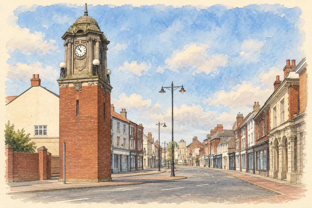
Watercolour and fine ink illustration of Wednesbury Town Centre Clock
Illustration · Wednesbury Town Centre Clock
History & heritage

Place & story

A market between roads and mineral ground

Wednesbury’s triangular Market Place grew between roads leading towards crossings of the Tame. Archaeology places occupation there before the formal market charter of 1707. That charter authorised a Friday market and two annual fairs, giving legal form to a commercial centre already shaped by movement and exchange. [3]

The resources beneath the town supported several kinds of work. Coal pits and ironstone appear in a dower document of 1315. Later pottery manufacture left tangible evidence: a seventeenth-century kiln excavated in Market Place produced coarse vessels, including jars and cisterns. Mining and making belonged to this settlement long before its great nineteenth-century factories. [4]

Making tubes from an older metal trade

Gunlocks and gun barrels were important local products during the Napoleonic Wars. Wrought-iron tubes followed: John Russell began making them in 1811 and established works with his brother James in 1816. James founded the Crown Tube Works in 1823. This sequence shows a manufacturing town changing its products rather than beginning industry from scratch. [4]

Transport helped connect production with customers. The Birmingham Canal reached the Wednesbury coalfield in 1769. Road traffic brought another trade in food, lodging and services, but the opening of Telford’s Holyhead Road in 1826 diverted long-distance coaches south of the old centre. Routes could support prosperity while also changing where business gathered. [3]

Religious conviction and violence

The Methodist society established in 1742 drew members from Wednesbury and neighbouring towns. Charles Wesley preached that autumn; John followed in January 1743. Their growing following met violent opposition. The Methodist historical dictionary records attacks on homes and possessions as well as on the preachers, making the riots a story of ordinary adherents’ vulnerability. [5]

The damage was intensely personal. The dictionary describes the breaking of widow Elizabeth Lingham’s goods and spinning wheel, and violence against the household of collier Valentine Ambersly. Wesley’s published defence, Modern Christianity exemplified at Wednesbury, appeared in 1745. The disturbances expose divisions within a working community rather than a simple opposition between an industrial town and outside religion. [5]

A pit mound becomes a public park

Brunswick Park turned industrial ground into a place for public recreation. The local authority bought the former pit mound from the Patent Shaft and Axletree Company in 1886. Before commissioning its designer, a committee visited Abbey Park in Leicester to inspect the work of William Barron and Son. Wednesbury was drawing on experience elsewhere to plan a new local amenity. [6]

The park opened on 21 June 1887. Its designers retained the mound, laying paths to a levelled summit rather than erasing every trace of the site’s earlier use. The arrangement subsequently changed: a bandstand was repositioned, the pool was reshaped, and bowling greens, tennis courts and a putting green were added in the interwar period. The park became a layered record of recreation built around an industrial landform. [6]

Art made public

The Richards Art Gallery and Museum gave cultural ambition a substantial setting on Holyhead Road. Wood and Kendrick designed the building, whose foundation stone records 1890. Brick and terracotta form a symmetrical front, with a tall lower storey and an upper level without windows. Its deliberate public presence offered a different expression of the town’s wealth from the factory gate. [2]

The façade links local patronage with national models of accomplishment. Relief portraits represent Christopher Wren, Joshua Reynolds, John Flaxman and Isaac Newton; busts above the doorway commemorate the gallery committee chairman William Lloyd and Mayor Williams. The museum collection also reflects particular choices: Sandwell’s collections policy identifies the Richards family’s bequest as the major source of its fine art holdings, shaped by the family’s tastes and attitudes. [2] [7]

The centre and the changing road

The northern relief road, built in 1969, separated Market Place from the old parish church and diverted traffic. Industrial closures in the following decades brought unemployment and commercial change. The streets retained much of their historic pattern even as the economy around them altered. [3]

Back to contents
Lives connected to this place

Notable people

John and James Russell: changing the product

John Russell combined gun-barrel making with keeping the Turk’s Head Inn before entering tube manufacture. His partnership with James tied a new trade to established skills and premises in Wednesbury. James’s separate Crown works made the brothers part of the town’s diversification, though their careers should not be collapsed into a single business. [4]

Mary Ann Richards: a gift heard as well as seen

Mary Ann Richards’s patronage connected the art gallery with the religious life of Wood Green. The Lichfield diocesan committee’s records identify her as the gallery’s founder and as the donor of St Paul’s eight bells in 1887. Her name appeared on two bells. The same records describe a board commemorating a 1926 peal rung entirely by Elwell employees, a striking connection between church music and the workplace. [8]

Back to contents
A chronology

Timeline

Wednesbury through time

  1. 1315 — A dower document records local coal pits and ironstone mining. [4]

  2. 1707 — A charter grants a Friday market and two annual fairs. [3]

  3. 1743–44 — Methodist adherents and preachers face violent attacks. [5]

  4. 1769 — The Birmingham Canal reaches the Wednesbury coalfield. [3]

  5. 1823 — James Russell establishes Crown Tube Works. [4]

  6. 1887 — Brunswick Park opens on 21 June. [6]

  7. 1890 — The gallery’s foundation stone records its date. [2]

  8. 1969 — The northern relief road changes traffic through the centre. [3]

Back to contents

Population over time

Built-up area · Settlement · Census 2021

Wednesbury

20,315people · 2021

Census 2021 population of the named settlement, using ONS built-up area boundaries.

Published census counts.

Sources: ONS: Towns and cities, characteristics of built-up areas, Census 2021 (Table 1c)

View population figures
Wednesbury — census population
Census yearPopulation
202120,315
Sources and how to read this chart

Usual residents on 21 March 2021; published ONS count rounded to the nearest 5.. Boundary geography: December 2022 (E63002782).

Census 2021 population of the named settlement, using ONS built-up area boundaries.

ONS Table 1c rounds counts to the nearest 5 and suppresses counts below 10. Matched by exact settlement name or individually reviewed district-qualified name, with its coordinate strictly inside that same official BUA boundary. The 2022 BUA geography changed methodology and cannot be directly compared with 2011 BUAs. Contains OS data © Crown copyright and database right 2026. Contains National Statistics data © Crown copyright and database right 2026.

Source: ONS: Towns and cities, characteristics of built-up areas, Census 2021 (Table 1c). Open Government Licence v3.0. Retrieved 2026-10-26. Source: ONS and Ordnance Survey: Built Up Areas December 2022 GB BGG. Open Government Licence v3.0. Retrieved 2026-10-26.

Neighbourhood census context

These figures describe statistical neighbourhoods, which may cover part of a place or include neighbouring places.

Neighbourhood census area · 1971–2021

Sandwell 005

Population of the area containing the recorded point for Wednesbury, not the whole place. This area may cover part of the place or include neighbours.

02k4k6k8k1971: 6,866 people19711981: 6,746 people19811991: 6,485 people19912001: 6,311 people20012011: 6,459 people20112021: 7,553 people2021

Includes harmonised historical census estimates.

Sources: ONS · Paul Norman

View population figures
Sandwell 005 — census population and harmonised historical estimates
Census yearPopulation
19716,866
19816,746
19916,485
20016,311
20116,459
20217,553
Sources and how to read this chart

Usual residents of the containing MSOA; this is local area context, not the population of the named settlement.. Boundary geography: 1 April 2022 (E02002047).

2011 and 2021 census counts harmonised by ONS to the same 1 April 2022 geography. Location matched to ONS 2021 MSOA polygons (full resolution, coastline clipped, V7). ONS exact-fit lookup marks this MSOA unchanged from 2011 (U); historical estimates use that same footprint.

1971–2011: Paul Norman harmonised historical estimates on 2011 MSOAs, rounded to whole residents (1971–1991 are modelled). 2021: ONS census count. The historical 2011 total can differ slightly from the ONS change-over-time 2011 total because of methodology and statistical disclosure controls. These are area estimates, not settlement totals.

Source: ONS Census change over time: usual resident population, 2011 and 2021. Open Government Licence v3.0. Retrieved 2026-10-26. Source: ONS MSOA December 2021 boundaries EW BFC V7. Open Government Licence v3.0. Retrieved 2026-10-26. Source: Paul Norman — Area characteristics: Great Britain 1971 to 2011. Creative Commons Attribution 4.0. Retrieved 2026-10-26. Source: ONS MSOA 2011 to MSOA 2021 exact-fit lookup for England and Wales. Open Government Licence v3.0. Retrieved 2026-10-26.

Recorded locationWednesbury52.55205° N · 2.01869° WInteractive map loads when this area enters view.
Approximate recorded location · Geographic source

Geographic context

Place type
Town
Country / region
England · West Midlands
County group
West Midlands
Current administration
Sandwell
Recorded coordinates
52.55205, -2.01869
OS Open Names ID
osgb4000000074566415

County groups are browsing aids. Current administrative and historic areas are recorded separately.

Recorded names

  • Wednesbury · en · official

Nearby heritage

Explore recorded heritage in Wednesbury and the surrounding area. This selection is based on proximity to a recorded settlement point; it is not a complete inventory or evidence that a site lies within the settlement or belongs to its history.

Heritage locationsWednesbury & surrounding areaInteractive map loads when this area enters view. Source records are listed below.

Numbered markers match the source records below. Locations are recorded reference points, not site boundaries.

  1. 31 AND 33, MARKET PLACE · Listed building
  2. Clock Tower in Wednesbury Market Place · Listed building
  3. DISTRICT PUBLIC LIBRARY WEDNESBURY · Listed building
  4. CENTRAL MEMORIAL IN MEMORIAL GARDENS · Listed building
  5. MEMORIAL ATTACHED TO NORTH WALL OF MEMORIAL GARDENS · Listed building
  6. RICHARDS ART GALLERY AND MUSEUM · Listed building
  7. CHURCH OF ST BARTHOLOMEW · Listed building
  8. CHURCH OF ST MARY · Listed building

Sources & further reading

  1. OS Open Names October 2026 · Source licence.
  2. Richards Art Gallery and Museum: list entry1077118 · Historic England
  3. Wednesbury Market Place Conservation Area Appraisal and Management Plan (January2024) · Sandwell Council
  4. Desk-based assessment of land adjacent to86 Walsall Street (2014), report2116 · Elizabeth Connolly / Worcestershire Archaeology
  5. Wednesbury riots,1743–1744 · Dictionary of Methodism in Britain and Ireland / Donald H Ryan and John A Vickers
  6. Brunswick Park: list entry1001298 · Historic England
  7. Sandwell Museum and Arts Service Collections Management Policy2021–26, appendix1 · Sandwell Council
  8. Lichfield Diocesan Advisory Committee minutes26 November2025 · Diocese of Lichfield
  9. Illustration of Wednesbury Town Centre Clock, adapted from Wednesbury Town Centre Clock - geograph.org.uk - 991935.jpg by Row17. CC BY-SA 2.0. AI-assisted watercolour and fine ink adaptation; cream paper margins, simplified fine detail and removal of incidental street clutter.

Geographic source retrieved 2026-10-26. History last researched 2026-10-27. How this page was prepared.