Town

Willenhall

Family lockmaking businesses survived beside larger factories in Willenhall, while epidemic disease prompted the long work of improving public health.

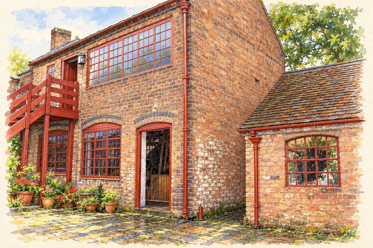
Watercolour and fine ink illustration of The Locksmiths House workshop
Illustration · The Locksmiths House workshop
History & heritage

Place & story

A village drawn into manufacturing

Willenhall was once a small settlement within the large parish of Wolverhampton. Its later centre gathered around Market Place and Stafford Street, where homes, workshops and public houses crowded narrow streets. Trade also shaped the surrounding communities: Lane Head and Sandbeds developed with mining, while Portobello grew with brickmaking. These were connected places with different kinds of work, rather than an undifferentiated industrial town. [3]

New Road opened in the early nineteenth century to help trade. The name describes a practical change in movement through a town whose production often remained small in scale. Even after the arrival of railways and electric trams, the carrier’s cart still had a place: writing in 1908, Frederick William Hackwood linked its survival to the many small parcels sent to Wolverhampton, Birmingham and other nearby markets. [3] [5]

Locks, machines and the small master

The concentration of lockmaking skills gave Willenhall its particular industrial identity. By the early twentieth century large factories were changing the trade, but they had not swept away the businesses behind family homes. At 54 New Road, the surviving house and workshops preserve that close physical relationship between earning a living and running a household. [2]

Hackwood’s account of the trade shows that small workshops were capable of adopting machinery. He records Isaac Mason’s move from Bilston to Willenhall in 1796 and associates him with the fly press used to make lock parts. Production could therefore change through specialised tools without every operation being gathered into a single large factory. The town’s industrial story includes this intermediate world of skilled makers and mechanical aids. [5]

Cholera and the responsibilities of government

The sandstone memorial at Doctor’s Piece records the shock of the 1849 cholera epidemic. Its inscription gives 17 August as the first death and 4 October as the last, with 292 deaths in forty-nine days. St Giles’s churchyard had become too crowded, and part of the church estate was used for burials before consecration. The inscription also records the interruption of the town’s business and industry: the epidemic was a collective crisis as well as a series of household tragedies. [4]

Willenhall formed a Local Board of Health in 1854. Improvement was gradual: Hackwood dates the appointment of its first medical officer of health to 1866 and the completion of the town’s sewerage to 1890. He also records that Wolverhampton Corporation bought the local waterworks in 1868. The response to disease required administration, professional oversight and systems extending beyond individual properties. [5]

Reading, recreation and remembrance

Public culture grew alongside sanitary administration. Hackwood describes the 1857 exhibition of art and industry, opened during Wake week, and presents the Free Library as one of its legacies. An exhibition could offer a different use of a traditional holiday while displaying the relationship between craftsmanship and art. His account is itself evidence of the reforming ambitions with which some townspeople approached popular recreation. [5]

Later public amenities extended the spaces available beyond work and home. A memorial park opened in 1922 to honour those killed in the First World War, and public baths followed in 1938. These additions placed remembrance and bodily recreation within the town’s shared institutions. [3]

Back to contents
Lives connected to this place

Notable people

John and Edgar Hodson: keeping a family business going

John Hodson owned Richard Hodson & Sons when the family bought the whole New Road property in 1904, having previously rented its workshops. After his death his son Edgar continued making bar padlocks and lighter locks, later also stamping spanners and supplying oven-door parts. Their significance lies in the survival and adaptation of a particular local business. The house became a museum in 1987; its 1905 setting uses many original family possessions. [2]

Richard Wilkes: physician and keeper of records

Richard Wilkes (1690–1760) combined medicine with antiquarian research. Hackwood records that, after practising in Wolverhampton, he settled with his father at Willenhall following his marriage in 1725. His historical manuscripts later supplied material for Stebbing Shaw’s history of Staffordshire. Wilkes matters here both as a resident physician and as someone whose patient collecting helped later generations investigate the county’s past. [5]

Back to contents
A chronology

Timeline

Willenhall through time

  1. 1796 — According to Hackwood, Isaac Mason moves from Bilston to Willenhall, bringing his experience of machinery for making lock parts. [5]

  2. 1849 — Cholera kills 292 people in forty-nine days, as recorded on the Doctor’s Piece memorial. [4]

  3. 1854 — The Local Board of Health is established. [5]

  4. 1857 — An exhibition of art and industry opens during Wake week. [5]

  5. 1890 — Hackwood dates completion of the town’s sewerage to this year. [5]

  6. 1904 — The Hodson family buys its home and workshops at 54 New Road. [2]

  7. 1922 — The memorial park opens in honour of the First World War dead. [3]

  8. 1987 — The Locksmith’s House opens to the public. [2]

Back to contents

Population over time

Built-up area · Settlement · Census 2021

Willenhall

49,580people · 2021

Census 2021 population of the named settlement, using ONS built-up area boundaries.

Published census counts.

Sources: ONS: Towns and cities, characteristics of built-up areas, Census 2021 (Table 1c)

View population figures
Willenhall — census population
Census yearPopulation
202149,580
Sources and how to read this chart

Usual residents on 21 March 2021; published ONS count rounded to the nearest 5.. Boundary geography: December 2022 (E63002699).

Census 2021 population of the named settlement, using ONS built-up area boundaries.

ONS Table 1c rounds counts to the nearest 5 and suppresses counts below 10. Matched by exact settlement name or individually reviewed district-qualified name, with its coordinate strictly inside that same official BUA boundary. The 2022 BUA geography changed methodology and cannot be directly compared with 2011 BUAs. Contains OS data © Crown copyright and database right 2026. Contains National Statistics data © Crown copyright and database right 2026.

Source: ONS: Towns and cities, characteristics of built-up areas, Census 2021 (Table 1c). Open Government Licence v3.0. Retrieved 2026-10-26. Source: ONS and Ordnance Survey: Built Up Areas December 2022 GB BGG. Open Government Licence v3.0. Retrieved 2026-10-26.

Neighbourhood census context

These figures describe statistical neighbourhoods, which may cover part of a place or include neighbouring places.

Neighbourhood census area · 1971–2021

Walsall 025

Population of the area containing the recorded point for Willenhall, not the whole place. This area may cover part of the place or include neighbours.

02.5k5k7.5k10k1971: 7,444 people19711981: 7,519 people19811991: 7,721 people19912001: 7,673 people20012011: 8,236 people20112021: 9,235 people2021

Includes harmonised historical census estimates.

Sources: ONS · Paul Norman

View population figures
Walsall 025 — census population and harmonised historical estimates
Census yearPopulation
19717,444
19817,519
19917,721
20017,673
20118,236
20219,235
Sources and how to read this chart

Usual residents of the containing MSOA; this is local area context, not the population of the named settlement.. Boundary geography: 1 April 2022 (E02002134).

2011 and 2021 census counts harmonised by ONS to the same 1 April 2022 geography. Location matched to ONS 2021 MSOA polygons (full resolution, coastline clipped, V7). ONS exact-fit lookup marks this MSOA unchanged from 2011 (U); historical estimates use that same footprint.

1971–2011: Paul Norman harmonised historical estimates on 2011 MSOAs, rounded to whole residents (1971–1991 are modelled). 2021: ONS census count. The historical 2011 total can differ slightly from the ONS change-over-time 2011 total because of methodology and statistical disclosure controls. These are area estimates, not settlement totals.

Source: ONS Census change over time: usual resident population, 2011 and 2021. Open Government Licence v3.0. Retrieved 2026-10-26. Source: ONS MSOA December 2021 boundaries EW BFC V7. Open Government Licence v3.0. Retrieved 2026-10-26. Source: Paul Norman — Area characteristics: Great Britain 1971 to 2011. Creative Commons Attribution 4.0. Retrieved 2026-10-26. Source: ONS MSOA 2011 to MSOA 2021 exact-fit lookup for England and Wales. Open Government Licence v3.0. Retrieved 2026-10-26.

Recorded locationWillenhall52.58314° N · 2.05433° WInteractive map loads when this area enters view.
Approximate recorded location · Geographic source

Geographic context

Place type
Town
Country / region
England · West Midlands
County group
West Midlands
Current administration
Walsall
Recorded coordinates
52.58314, -2.05433
OS Open Names ID
osgb4000000074561022

County groups are browsing aids. Current administrative and historic areas are recorded separately.

Recorded names

  • Willenhall · en · official

Nearby heritage

Distances are from the recorded place point. Proximity does not establish that a site lies within the place boundary or belongs to its history.

Sources & further reading

  1. OS Open Names October 2026 · Source licence.
  2. The Locksmiths House · Black Country Living Museum
  3. Willenhall in history · Walsall Council / Walsall Local History Centre
  4. Cholera Memorial, Doctor’s Piece Gardens: list entry 1343038 · Historic England
  5. The Annals of Willenhall (1908) · Frederick William Hackwood
  6. Illustration of The Locksmiths House workshop, adapted from Willenhall Locksmiths Workshop.JPG by Brianboru100. CC BY-SA 4.0. AI-assisted watercolour and fine ink adaptation; incidental clutter simplified, warm cream paper margins. Architectural forms follow the inspected reference.

Geographic source retrieved 2026-10-26. History last researched 2026-10-27. How this page was prepared.