City

Wolverhampton

Around St Peter’s, medieval trading streets developed into an industrial town. Motor works, public art collections and houses opened to visitors preserve different parts of Wolverhampton’s working and civic life.

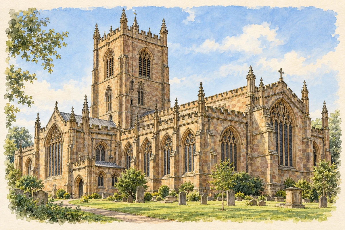
Watercolour and fine ink illustration of St Peter’s Collegiate Church, Wolverhampton
Illustration · St Peter’s Collegiate Church, Wolverhampton
Original illustration; researched sources
Research sources

Original architectural composition based on the cited building descriptions; incidental setting and fine details are interpretive.

Historic England: Church of St Peter; Wolverhampton parish profile

History & heritage

Place & story

The hilltop before the factories

Wolverhampton grew around a minster on the site of St Peter’s. A market is recorded from the twelfth century, and wool trading brought medieval prosperity. The church and the streets around it formed an older commercial centre before the expansion of metal manufacture. [3]

St Peter’s preserves several building campaigns. Its crossing and south transept are late thirteenth century; the nave, tower and north transept largely date from the later fifteenth century. Ewan Christian’s work in 1852–65 supplied a new chancel and restoration. Medieval roofs, a stone pulpit and later fittings make the church a record of changing craftsmanship and worship. [2]

Making a town governable

An Improvement Act of 1777 appointed commissioners to address practical urban problems. They introduced street lighting, required householders to clean outside their properties and improved water provision with wells and a market-place tank. These measures belong beside the history of manufacture: a growing commercial town also needed water, cleaner streets and organised administration. [3]

From metal finishing to motor manufacture

In Blakenhall, the history of the Sunbeam works shows how one trade could provide premises for another. Edward Bullifant’s tin and japan works existed by 1884. In 1898 John Marston bought the former works and converted them to bicycle-pedal production for his Sunbeam cycle business. His son Charles ran the enterprise known as the Villiers Cycle Company. [4]

The first Sunbeam motor car was built in 1899 in a former coach house behind Moorfields, beside these premises. Wessex Archaeology’s building study traces the development of extensive factories from that small beginning. The district’s industrial fabric therefore records changes in products and production space, rather than a single factory appearing fully formed. [4]

Art within an industrial town

Wolverhampton Art Gallery opened on 30 May 1884 with an exhibition that included painting and lace alongside working carpet looms, machinery and manufactured metal goods. Its early combination of art and manufacture makes sense in a town where design and making were closely connected. Private subscriptions and a government grant helped fund the building shared by gallery and art school. [6]

The gallery’s later collections include Pop Art and work by Black British artists. These holdings extend its remit beyond remembering Victorian benefactors. A civic collection can record changing artistic concerns and bring different experiences into public view while remaining close to the older church and commercial centre. [5]

Private houses become public inheritance

Bantock House was the home of Thomas Bantock, a canal and railway agent who also served as mayor. His descendants bequeathed it to the town in 1938. Used by the Home Guard during the Second World War, the property became a museum in April 1948. Its domestic rooms and grounds entered civic life through successive changes of purpose. [7]

Wightwick Manor, west of the town centre, represents a different relationship between manufacturing and domestic life. Built for Theodore and Flora Mander in 1887–93, it drew on the wealth of the family’s Wolverhampton paint and varnish business. Edward Ould’s timber-framed design deliberately looked older than it was; Morris furnishings and other decorative work expressed the owners’ artistic interests. [8]

In 1937 Geoffrey Mander gave Wightwick, its contents and an endowment to the National Trust. Preserving a house only about fifty years old was an unusual step at the time. The family continued living there, so the gift began a period of public stewardship alongside continued residence. [8]

Back to contents
Lives connected to this place

Notable people

Wulfrun: a foundation recorded in documents

Wulfrun, a Mercian noblewoman, received land at Heantun from King Ethelred in 985 and endowed the minster in 994. These documented acts establish her connection with the town’s beginnings; the later city should not be projected backwards onto the smaller settlement she knew. [3]

Rosalie Mander: building an art collection

Rosalie Mander helped make Wightwick a significant home for Pre-Raphaelite art. A biographer with strong knowledge of the movement, she cultivated relationships with artists’ descendants and developed the collection with Geoffrey. Their acquisitions included work by women such as Elizabeth Siddal, Marie Spartali Stillman and Evelyn de Morgan. Her contribution was sustained collecting and interpretation in a house connected with Wolverhampton industry. [8]

Billy Wright: a career with Wolves

Billy Wright was born in Ironbridge; his Wolverhampton connection was his football career. The club records his years with Wolves as 1938–59 and 541 appearances. He captained the side to the 1949 FA Cup and three First Division titles, and played 105 times for England. These achievements connect the city’s sporting history with a player who arrived as a trainee. [9]

Back to contents
A chronology

Timeline

Wolverhampton through time

  1. 985 / 994 — Wulfrun receives land at Heantun and later endows its minster. [3]

  2. Late thirteenth to fifteenth centuries — Major phases of the surviving St Peter’s Church are built. [2]

  3. 1777 — An Improvement Act creates town commissioners. [3]

  4. 1852–65 — Ewan Christian’s work adds a new chancel and restores St Peter’s. [2]

  5. 1884 — Wolverhampton Art Gallery opens. [6]

  6. 1887–93 — Wightwick Manor is built for Theodore and Flora Mander. [8]

  7. 1899 — The first Sunbeam car is built at Moorfields. [4]

  8. 1937 / 1938 — Wightwick passes to the National Trust; Bantock House is bequeathed to the town the following year. [8] [7]

  9. 1948 — Bantock House Museum opens. [7]

  10. 1949 — Billy Wright captains Wolves to the FA Cup. [9]

Back to contents

Population over time

Built-up area · Settlement · Census 2021

Wolverhampton

234,025people · 2021

Census 2021 population of the named settlement, using ONS built-up area boundaries.

Published census counts.

Sources: ONS: Towns and cities, characteristics of built-up areas, Census 2021 (Table 1c)

View population figures
Wolverhampton — census population
Census yearPopulation
2021234,025
Sources and how to read this chart

Usual residents on 21 March 2021; published ONS count rounded to the nearest 5.. Boundary geography: December 2022 (E63002713).

Census 2021 population of the named settlement, using ONS built-up area boundaries.

ONS Table 1c rounds counts to the nearest 5 and suppresses counts below 10. Matched by exact settlement name or individually reviewed district-qualified name, with its coordinate strictly inside that same official BUA boundary. The 2022 BUA geography changed methodology and cannot be directly compared with 2011 BUAs. Contains OS data © Crown copyright and database right 2026. Contains National Statistics data © Crown copyright and database right 2026.

Source: ONS: Towns and cities, characteristics of built-up areas, Census 2021 (Table 1c). Open Government Licence v3.0. Retrieved 2026-10-26. Source: ONS and Ordnance Survey: Built Up Areas December 2022 GB BGG. Open Government Licence v3.0. Retrieved 2026-10-26.

Neighbourhood census context

These figures describe statistical neighbourhoods, which may cover part of a place or include neighbouring places.

Neighbourhood census area · 1971–2021

Wolverhampton 020

Population of the area containing the recorded point for Wolverhampton, not the whole place. This area may cover part of the place or include neighbours.

05k10k15k20k1971: 10,953 people19711981: 10,022 people19811991: 9,267 people19912001: 8,773 people20012011: 10,367 people20112021: 11,532 people2021

Includes harmonised historical census estimates.

Sources: ONS · Paul Norman

View population figures
Wolverhampton 020 — census population and harmonised historical estimates
Census yearPopulation
197110,953
198110,022
19919,267
20018,773
201110,367
202111,532
Sources and how to read this chart

Usual residents of the containing MSOA; this is local area context, not the population of the named settlement.. Boundary geography: 1 April 2022 (E02002168).

2011 and 2021 census counts harmonised by ONS to the same 1 April 2022 geography. Location matched to ONS 2021 MSOA polygons (full resolution, coastline clipped, V7). ONS exact-fit lookup marks this MSOA unchanged from 2011 (U); historical estimates use that same footprint.

1971–2011: Paul Norman harmonised historical estimates on 2011 MSOAs, rounded to whole residents (1971–1991 are modelled). 2021: ONS census count. The historical 2011 total can differ slightly from the ONS change-over-time 2011 total because of methodology and statistical disclosure controls. These are area estimates, not settlement totals.

Source: ONS Census change over time: usual resident population, 2011 and 2021. Open Government Licence v3.0. Retrieved 2026-10-26. Source: ONS MSOA December 2021 boundaries EW BFC V7. Open Government Licence v3.0. Retrieved 2026-10-26. Source: Paul Norman — Area characteristics: Great Britain 1971 to 2011. Creative Commons Attribution 4.0. Retrieved 2026-10-26. Source: ONS MSOA 2011 to MSOA 2021 exact-fit lookup for England and Wales. Open Government Licence v3.0. Retrieved 2026-10-26.

Recorded locationWolverhampton52.58620° N · 2.12992° WInteractive map loads when this area enters view.
Approximate recorded location · Geographic source

Geographic context

Place type
City
Country / region
England · West Midlands
County group
West Midlands
Current administration
City of Wolverhampton
Recorded coordinates
52.58620, -2.12992
OS Open Names ID
osgb4000000074561827

County groups are browsing aids. Current administrative and historic areas are recorded separately.

Recorded names

  • Wolverhampton · en · official

Nearby heritage

Distances are from the recorded place point. Proximity does not establish that a site lies within the place boundary or belongs to its history.

Sources & further reading

  1. OS Open Names October 2026 · Source licence.
  2. Church of St Peter: list entry1282467 · Historic England
  3. City Centre Conservation Area Appraisal (March2007) · City of Wolverhampton Council
  4. Moorfields Quarter Conservation Area Character Appraisal (October2007) · Wessex Archaeology
  5. Inspectors give Bantock House seal of approval · City of Wolverhampton Council
  6. History of Wightwick Manor · National Trust
  7. Billy Wright: Hall of Fame · Wolverhampton Wanderers FC
  8. Original illustration of St Peter’s Collegiate Church, Wolverhampton by PlaceHistory. Researched sources are linked beneath the illustration. Original composition from inspected architectural facts; no source photograph copied or used as an image-edit input. Fine detail is interpretive, not a measured survey.

Geographic source retrieved 2026-10-26. History last researched 2026-10-26. How this page was prepared.