Village

Alvechurch

Alvechurch retains the plan of a medieval market settlement beneath later layers of building and industry. A vanished bishop’s palace, the canal and a brief episode of car manufacture connect its village streets with a wider history.

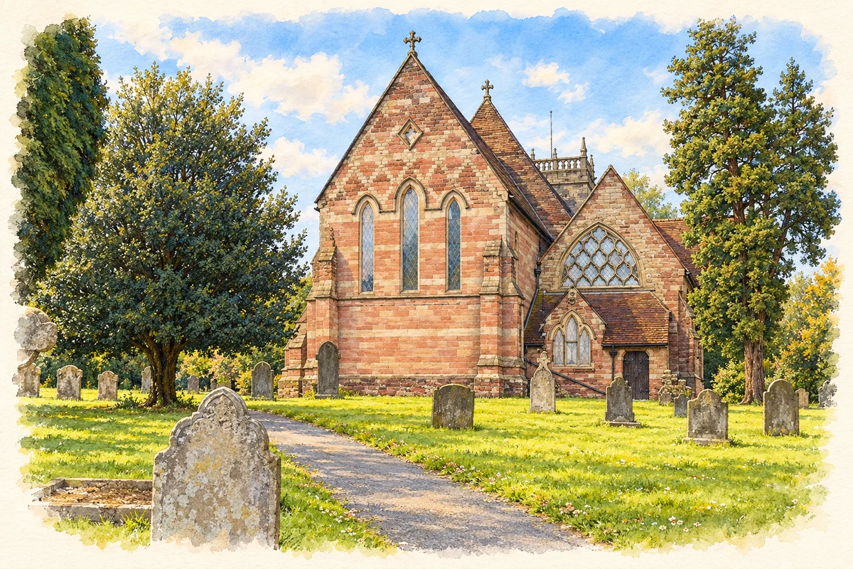
Watercolour and fine ink illustration of St Laurence’s Church, Alvechurch
Illustration · St Laurence’s Church, Alvechurch
History & heritage

Place & story

The bishop’s landscape

The Bishops of Worcester made Alvechurch a seat of ecclesiastical government. The parish neighbourhood plan places the creation of a palace, moat, gardens and fishponds in the twelfth century, alongside enclosure of land on Newbourne Hill for deer hunting. Bishops continued to live and conduct business here into the sixteenth century. [3]

In 1239 Alvechurch received a weekly market and an annual fair, with borough status following later. The fair was tied to the feast of St Laurence, the dedication of the parish church. The connection between the bishop’s household, religious life and trade helps explain the planned settlement whose form the conservation-area assessment recognises. [3] [2]

The palace was demolished in the seventeenth century, but its moat survived in the grounds of the Moat House in Radford Road. The former deer park was converted to farmland before 1700, with much of its boundary bank and ditch remaining visible. These earthworks preserve parts of an estate that is less obvious than the village streets. [3]

Reading Bear Hill and the Square

Timber framing and Georgian brick buildings together shape the centre. The council’s conservation account explains the long use of timber construction partly through available oak and the movement of clay and marl soils. Its account identifies 24, 26 and 28 Bear Hill as buildings dating from around the fifteenth century, although subsequently altered. [2]

The Old House on Bear Hill dates from the early seventeenth century and retains a more complete timber-framed character. Looking at it alongside later brick buildings reveals successive periods of rebuilding within the older layout. The conservation area was designated in November 1968, recognising the importance of the ensemble as well as individual buildings. [2]

Canal, railway and village employment

The canal reached Tardebigge in 1807 by way of Alvechurch, passing through this stretch without locks. In the parish it connects Alvechurch with Withybed Green, Hopwood and Lea End. The neighbourhood plan describes the waterway’s later role in walking, cycling, boating and fishing, alongside its surviving bridges and other historic structures. [3]

Alvechurch station dates from 1859. The railway subsequently became a link with Birmingham and Redditch, while improvements in 2015–16 formed another stage in its transport history. [3]

Industrial work also formed part of village and parish life. A brick factory at the neighbouring hamlet of Withybed operated from the nineteenth century into the middle of the twentieth; nailmaking and needlemaking were other local trades. Between 1949 and 1956 Dellow cars were manufactured in Alvechurch, a short motor-industry episode within a much longer history of work. [3]

Village and parish

The neighbourhood plan covers a wider area than the compact historic centre, including such settlements as Hopwood, Rowney Green and Bordesley. Its distinction between Alvechurch Village and the parish is useful when reading local history: a building, industry or population observation from the wider parish should retain its own location. [3]

Back to contents
A chronology

Timeline

Milestones

  1. Twelfth century: The bishop’s palace and deer park are established, according to the parish plan. [3]

  2. 1239: A weekly market and annual fair are granted. [3]

  3. Seventeenth century: The bishop’s palace is demolished. [3]

  4. 1807: The canal reaches Tardebigge through Alvechurch. [3]

  5. 1859: Alvechurch railway station is built. [3]

  6. 1949–56: Dellow cars are made in Alvechurch. [3]

  7. November 1968: The conservation area is designated. [2]

Back to contents

Population over time

Built-up area · Settlement · Census 2021

Alvechurch

3,410people · 2021

Census 2021 population of the named settlement, using ONS built-up area boundaries.

Published census counts.

Sources: ONS: Towns and cities, characteristics of built-up areas, Census 2021 (Table 1c)

View population figures
Alvechurch — census population
Census yearPopulation
20213,410
Sources and how to read this chart

Usual residents on 21 March 2021; published ONS count rounded to the nearest 5.. Boundary geography: December 2022 (E63003146).

Census 2021 population of the named settlement, using ONS built-up area boundaries.

ONS Table 1c rounds counts to the nearest 5 and suppresses counts below 10. Matched by exact settlement name or individually reviewed district-qualified name, with its coordinate strictly inside that same official BUA boundary. The 2022 BUA geography changed methodology and cannot be directly compared with 2011 BUAs. Contains OS data © Crown copyright and database right 2026. Contains National Statistics data © Crown copyright and database right 2026.

Source: ONS: Towns and cities, characteristics of built-up areas, Census 2021 (Table 1c). Open Government Licence v3.0. Retrieved 2026-10-26. Source: ONS and Ordnance Survey: Built Up Areas December 2022 GB BGG. Open Government Licence v3.0. Retrieved 2026-10-26.

Neighbourhood census context

These figures describe statistical neighbourhoods, which may cover part of a place or include neighbouring places.

Neighbourhood census area · 1971–2021

Bromsgrove 009

Population of the area containing the recorded point for Alvechurch, not the whole place. This area may cover part of the place or include neighbours.

01.8k3.5k5.3k7k1971: 5,828 people19711981: 5,854 people19811991: 6,007 people19912001: 6,300 people20012011: 6,574 people20112021: 6,932 people2021

Includes harmonised historical census estimates.

Sources: ONS · Paul Norman

View population figures
Bromsgrove 009 — census population and harmonised historical estimates
Census yearPopulation
19715,828
19815,854
19916,007
20016,300
20116,574
20216,932
Sources and how to read this chart

Usual residents of the containing MSOA; this is local area context, not the population of the named settlement.. Boundary geography: 1 April 2022 (E02006704).

2011 and 2021 census counts harmonised by ONS to the same 1 April 2022 geography. Location matched to ONS 2021 MSOA polygons (full resolution, coastline clipped, V7). ONS exact-fit lookup marks this MSOA unchanged from 2011 (U); historical estimates use that same footprint.

1971–2011: Paul Norman harmonised historical estimates on 2011 MSOAs, rounded to whole residents (1971–1991 are modelled). 2021: ONS census count. The historical 2011 total can differ slightly from the ONS change-over-time 2011 total because of methodology and statistical disclosure controls. These are area estimates, not settlement totals.

Source: ONS Census change over time: usual resident population, 2011 and 2021. Open Government Licence v3.0. Retrieved 2026-10-26. Source: ONS MSOA December 2021 boundaries EW BFC V7. Open Government Licence v3.0. Retrieved 2026-10-26. Source: Paul Norman — Area characteristics: Great Britain 1971 to 2011. Creative Commons Attribution 4.0. Retrieved 2026-10-26. Source: ONS MSOA 2011 to MSOA 2021 exact-fit lookup for England and Wales. Open Government Licence v3.0. Retrieved 2026-10-26.

Recorded locationAlvechurch52.35174° N · 1.95955° WInteractive map loads when this area enters view.
Approximate recorded location · Geographic source

Geographic context

Place type
Village
Country / region
England · West Midlands
County group
Worcestershire
Current administration
Bromsgrove
Current administration
Worcestershire
Recorded coordinates
52.35174, -1.95955
OS Open Names ID
osgb4000000074544092

County groups are browsing aids. Current administrative and historic areas are recorded separately.

Recorded names

  • Alvechurch · en · official

Nearby heritage

Distances are from the recorded place point. Proximity does not establish that a site lies within the place boundary or belongs to its history.

Sources & further reading

  1. OS Open Names October 2026 · Source licence.
  2. Alvechurch Conservation Area · Bromsgrove District Council
  3. Alvechurch Parish Neighbourhood Plan · Alvechurch Parish Council
  4. Illustration of St Laurence’s Church, Alvechurch, adapted from St. Laurence Church in Alvechurch,... by Lee J Andrews. CC BY-SA 2.0. AI-assisted watercolour and fine ink adaptation; cream paper margins, simplified fine detail and removal of incidental street clutter.

Geographic source retrieved 2026-10-26. History last researched 2026-10-26. How this page was prepared.