Town

Bewdley

The river brought merchants and workshops to Bewdley. Its bridge, railway station and living museum trace the changing ways this Severn town moved goods and preserved practical skills.

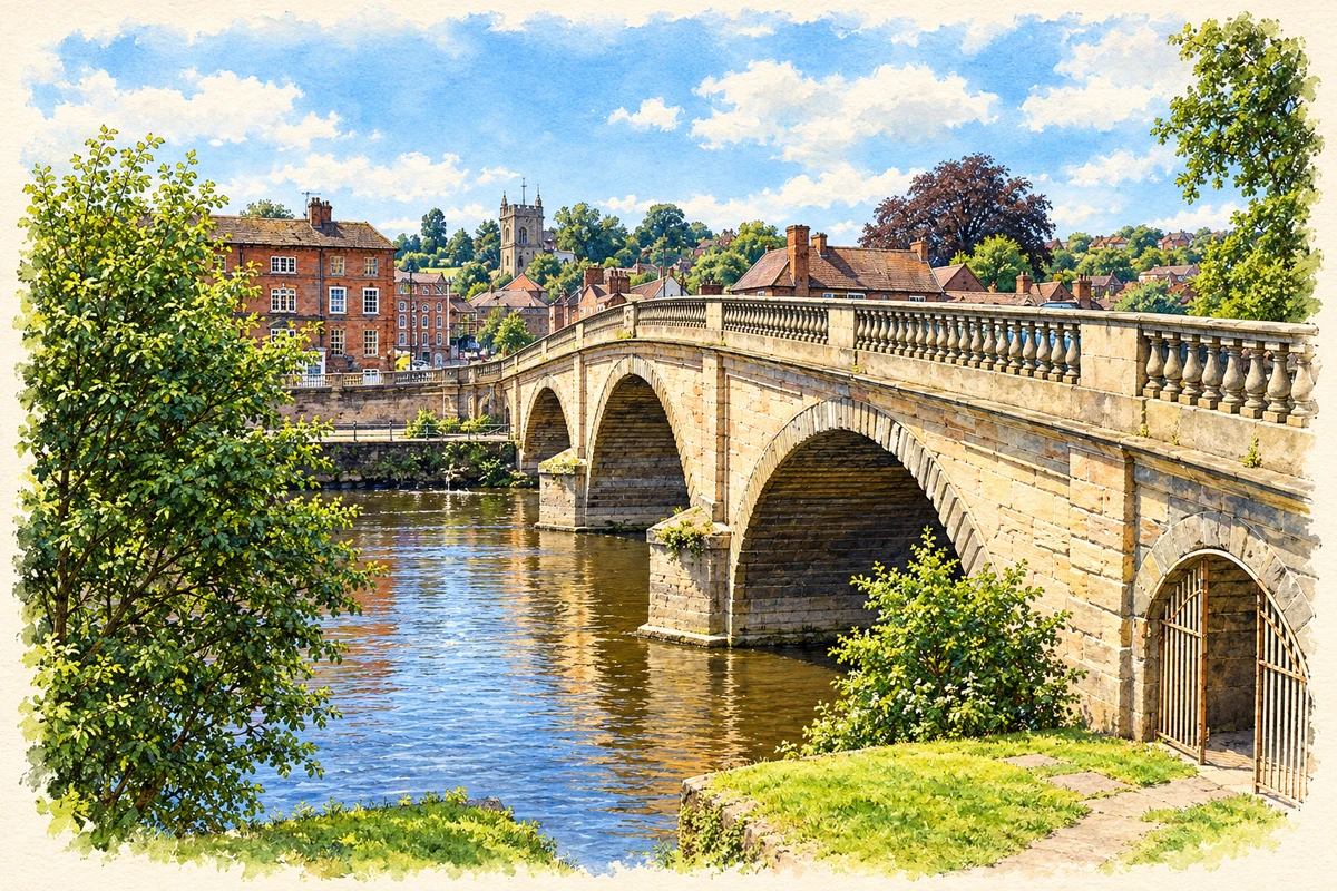
Watercolour and fine ink illustration of Bewdley Bridge over the Severn
Illustration · Bewdley Bridge over the Severn
History & heritage

Place & story

A port between river and road

Bewdley developed where the Severn connected boat transport with overland routes. A market was authorised in 1376 and Edward IV granted a borough charter in 1472. Cargoes arriving upstream could be transferred to packhorses for Wales and the Midlands; warehouses and wharfingers made the riverside a place of storage, bargaining and onward carriage. [2]

Nearby Wyre Forest supplied building timber, charcoal and bark for tanning. Leather, horn goods and caps joined forest produce among the town’s trades. Commerce also had distant and coercive connections: the Town Council’s historical account identifies goods imported through Bristol, including sugar and tobacco produced by enslaved labour in the West Indies, as sources of local wealth. [2]

A bridge rebuilt after flood

Floods partially destroyed the old bridge in 1795. Historic England dates Thomas Telford’s replacement to 1797–99 and identifies John Simpson as its contractor. The new crossing stood upstream of its predecessor, linking Bewdley and Wribbenhall. Its substantial stonework belongs to a period when this established river port faced growing competition from canal transport. [3]

Railways and continuing crafts

The canal terminus at nearby Stourport diverted trade, but Bewdley did not simply stop working. Brass founding, pewtering and comb making continued. The museum’s foundry history records Christopher Bancks arriving in 1697, a succession of later owners, purchase by H J Exley in 1923 and final closure in 1964. A long-lived workshop connects the port era with living memory. [2] [5]

Public railway services began in February 1862, with Bewdley station on the Wribbenhall side of the river. The Tenbury route opened in 1864, followed by the Kidderminster Loop in 1878. Preparing for the latter brought enlarged platforms, signal boxes and a footbridge, replacing the earlier practice of passengers crossing the tracks at ground level. [6] [2]

A museum built around doing

Bewdley Museum Trust formed in 1969 to create a living museum demonstrating craft skills. Restoration of the shambles began in 1971, when the buildings were serving as council storage. At the opening in 1972, Earl Baldwin untied the last rope made at John Lowes’ ropewalk: a practical trade became the centrepiece of a public institution. [4]

The ropewalk was the first operational exhibit; a brass foundry display followed in 1978. Other surviving spaces widen the story beyond manufacture. Town jails built in 1802 and a 1940 air-raid shelter for Post Office staff preserve evidence of punishment and wartime protection within the same museum setting. [4] [5]

Back to contents
Lives connected to this place

Notable people

Louisa Baldwin: writing within an industrial family

Louisa Macdonald married industrialist Alfred Baldwin in 1866 and came to live in Bewdley’s High Street. The house became a meeting place for her sisters and their families. The family moved to Wilden in 1870, close to Alfred’s ironworks. Louisa published poetry and supernatural stories, including The Shadow on the Blind and Other Stories; her life connects the district’s industrial households with literary work. [8]

Stanley Baldwin: a local birth and parliamentary seat

Stanley Baldwin was born in Bewdley on 3 August 1867 and succeeded his father as the constituency’s MP in 1908. He served three terms as Prime Minister, in 1923–24, 1924–29 and 1935–37. His later Worcestershire home was Astley Hall near Stourport, a separate place from the town of his birth. [7]

Back to contents
A chronology

Timeline

Bewdley through time

  1. 1376 — A market is authorised. [2]

  2. 1472 — Edward IV grants the town a borough charter. [2]

  3. 1697 — Brassfounder Christopher Bancks comes to Bewdley. [5]

  4. 1795 — Flooding damages the earlier Severn bridge. [3]

  5. 1797–99 — Telford’s replacement bridge is built by John Simpson. [3]

  6. 1862 — Public railway services begin through Bewdley. [6]

  7. 1878 — The Kidderminster Loop opens. [6]

  8. 1964 — The Exley family’s brass foundry closes. [5]

  9. 1969–72 — Museum trust formation and restoration lead to the museum’s opening. [4]

Back to contents

Population over time

A verified population series for Bewdley as a settlement has not yet been added. Neighbourhood census figures are available below.

Neighbourhood census context

These figures describe statistical neighbourhoods, which may cover part of a place or include neighbouring places.

Neighbourhood census area · 1971–2021

Wyre Forest 011

Population of the area containing the recorded point for Bewdley, not the whole place. This area may cover part of the place or include neighbours.

02k4k6k8k1971: 6,038 people19711981: 6,788 people19811991: 6,831 people19912001: 7,027 people20012011: 7,165 people20112021: 7,205 people2021

Includes harmonised historical census estimates.

Sources: ONS · Paul Norman

View population figures
Wyre Forest 011 — census population and harmonised historical estimates
Census yearPopulation
19716,038
19816,788
19916,831
20017,027
20117,165
20217,205
Sources and how to read this chart

Usual residents of the containing MSOA; this is local area context, not the population of the named settlement.. Boundary geography: 1 April 2022 (E02006777).

2011 and 2021 census counts harmonised by ONS to the same 1 April 2022 geography. Location matched to ONS 2021 MSOA polygons (full resolution, coastline clipped, V7). ONS exact-fit lookup marks this MSOA unchanged from 2011 (U); historical estimates use that same footprint.

1971–2011: Paul Norman harmonised historical estimates on 2011 MSOAs, rounded to whole residents (1971–1991 are modelled). 2021: ONS census count. The historical 2011 total can differ slightly from the ONS change-over-time 2011 total because of methodology and statistical disclosure controls. These are area estimates, not settlement totals.

Source: ONS Census change over time: usual resident population, 2011 and 2021. Open Government Licence v3.0. Retrieved 2026-10-26. Source: ONS MSOA December 2021 boundaries EW BFC V7. Open Government Licence v3.0. Retrieved 2026-10-26. Source: Paul Norman — Area characteristics: Great Britain 1971 to 2011. Creative Commons Attribution 4.0. Retrieved 2026-10-26. Source: ONS MSOA 2011 to MSOA 2021 exact-fit lookup for England and Wales. Open Government Licence v3.0. Retrieved 2026-10-26.

Recorded locationBewdley52.37583° N · 2.31504° WInteractive map loads when this area enters view.
Approximate recorded location · Geographic source

Geographic context

Place type
Town
Country / region
England · West Midlands
County group
Worcestershire
Current administration
Wyre Forest
Current administration
Worcestershire
Recorded coordinates
52.37583, -2.31504
OS Open Names ID
osgb4000000074565764

County groups are browsing aids. Current administrative and historic areas are recorded separately.

Recorded names

  • Bewdley · en · official

Nearby heritage

Distances are from the recorded place point. Proximity does not establish that a site lies within the place boundary or belongs to its history.

Sources & further reading

  1. OS Open Names October 2026 · Source licence.
  2. Bewdley History · Bewdley Town Council / Bewdley Historical Research Group
  3. Severn Bridge including flanking arches and balustrade, list entry 1100000 · Historic England
  4. History of the museum · Bewdley Museum
  5. Displays · Bewdley Museum
  6. Bewdley Station: The coming of the railways · Severn Valley Railway
  7. A famous Worcestershire resident · Worcestershire Archive and Archaeology Service
  8. Macdonald sisters · Bewdley Museum
  9. Illustration of Bewdley Bridge over the Severn, adapted from Bewdley Bridge by Philip Pankhurst. CC BY-SA 2.0. AI-assisted watercolour and fine ink adaptation; cream paper margins, simplified fine detail and removal of incidental street clutter.

Geographic source retrieved 2026-10-26. History last researched 2026-10-26. How this page was prepared.