Village

Broadway

Broadway’s broad street served long-distance travellers, then became part of a village known for painting and furniture design as well as its inns.

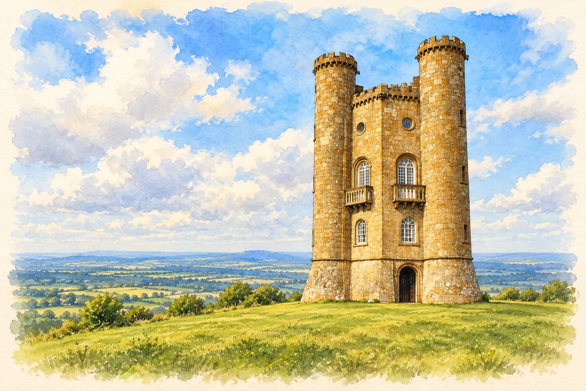
Watercolour and fine ink illustration of Broadway Tower
Illustration · Broadway Tower
History & heritage

Place & story

An older centre away from the High Street

St Eadburgha’s stands more than a kilometre south of today’s village centre. Wychavon’s conservation appraisal treats it as the likely focus of early settlement, before the centre shifted. A charter of 972, granting the estate to Pershore Abbey, supplies an early documentary reference. The church’s separation from the modern High Street preserves a clue to a changing settlement rather than an unchanged village plan. [3]

The building itself contains several periods. Historic England dates much of it to about 1400, with late-twelfth-century remains, later additions and an 1866 restoration. Medieval woodwork survives in reused pieces in the screens, choir benches and pulpit. St Michael and All Angels, built by Harvey Eginton in 1840 in the village centre, later took over the role of parish church. [4] [5]

A street serving the road

Broadway Museum places the village’s coaching story between the later seventeenth century and about 1850. Travellers between London and Wales needed meals, beds and fresh arrangements for onward travel. The White Hart, now the Lygon Arms, the Fish, Bell and Angel inns formed part of this economy. Their buildings record a village whose income depended partly on people passing through. [2]

Rail travel changed that trade by offering faster, cheaper and more comfortable journeys. The museum interprets the change in surviving seventeenth-century spaces, connecting rooms and inns to a transport network rather than treating their age alone as the story. [2]

A village becomes a place to paint

In August 1885 Edwin Austin Abbey brought John Singer Sargent to stay with Frank Millet’s family at Broadway after a boating accident on the Thames. At Farnham House, facing the village green, Sargent began the garden composition that became Carnation, Lily, Lily, Rose. The picture developed through repeated work in 1885 and 1886, not a single evening’s view. [8]

Tate’s conservation researchers connect letters, drawings and examination of the canvas to reconstruct that work. A first idea using Millet’s daughter changed into a more complex composition. Broadway was a setting in which friends’ houses, gardens, visiting artists and models enabled sustained experimentation. [8]

From hotel repairs to manufacture

The Russell family’s purchase of the Lygon Arms in 1904 created another route from hospitality into craft. Gordon Russell worked in the family’s antique repair and restoration business before Russell and Sons was established in 1922. He combined skilled handwork with machinery, seeking well-designed furniture for a wider market. [6]

The workshops adapted to wartime production, including aircraft recognition models and Mosquito components. Women joined the skilled workforce. Incendiary bombing damaged the Broadway factory in November 1940 and destroyed a medieval barn. This manufacturing history complicates the village’s familiar image as a retreat from industry. [6]

A surviving coffee table in the Museum of the Home gives the later business a precise material record. Designed by Trevor Chinn in 1957 and manufactured at Broadway by Gordon Russell Ltd, it combines veneers and solid edging with a simple raised frame. Its manufacturer’s plate explicitly identifies Broadway, Worcestershire. [7]

Back to contents
Lives connected to this place

Notable people

Gordon Russell: learning and making in Broadway

Gordon Russell moved to Broadway aged twelve in 1904. Schooling at Chipping Campden and work with the Lygon Arms craftsmen helped form his design education. His significance to Broadway rests on founding and developing a manufacturing business here, as well as a later national role in design and Utility furniture. [6]

John Singer Sargent: a working visitor

Sargent’s connection was that of a visiting painter working among friends. His Broadway studies and the making of Carnation, Lily, Lily, Rose in 1885–86 give the association a specific artistic basis. He was neither born in the village nor simply a famous guest passing through an inn. [8]

Back to contents
A chronology

Timeline

Broadway through time

  1. 972 — A charter grants the Broadway estate to Pershore Abbey. [3]

  2. About 1400 — Major medieval work shapes St Eadburgha’s church. [4]

  3. 1840 — St Michael and All Angels is built in the village centre. [5]

  4. 1885–86 — Sargent works on Carnation, Lily, Lily, Rose at Broadway. [8]

  5. 1904 — The Russell family buys the Lygon Arms. [6]

  6. 1922 — Russell and Sons is established. [6]

  7. November 1940 — Incendiaries hit the Broadway furniture factory. [6]

  8. 1957 — Trevor Chinn designs a coffee table manufactured by Gordon Russell Ltd at Broadway. [7]

Back to contents

Population over time

Built-up area · Settlement · Census 2021

Broadway

2,720people · 2021

Census 2021 population of the named settlement, using ONS built-up area boundaries.

Published census counts.

Sources: ONS: Towns and cities, characteristics of built-up areas, Census 2021 (Table 1c)

View population figures
Broadway — census population
Census yearPopulation
20212,720
Sources and how to read this chart

Usual residents on 21 March 2021; published ONS count rounded to the nearest 5.. Boundary geography: December 2022 (E63003873).

Census 2021 population of the named settlement, using ONS built-up area boundaries.

ONS Table 1c rounds counts to the nearest 5 and suppresses counts below 10. Matched by exact settlement name or individually reviewed district-qualified name, with its coordinate strictly inside that same official BUA boundary. The 2022 BUA geography changed methodology and cannot be directly compared with 2011 BUAs. Contains OS data © Crown copyright and database right 2026. Contains National Statistics data © Crown copyright and database right 2026.

Source: ONS: Towns and cities, characteristics of built-up areas, Census 2021 (Table 1c). Open Government Licence v3.0. Retrieved 2026-10-26. Source: ONS and Ordnance Survey: Built Up Areas December 2022 GB BGG. Open Government Licence v3.0. Retrieved 2026-10-26.

Neighbourhood census context

These figures describe statistical neighbourhoods, which may cover part of a place or include neighbouring places.

Neighbourhood census area · 1971–2021

Wychavon 018

Population of the area containing the recorded point for Broadway, not the whole place. This area may cover part of the place or include neighbours.

01.8k3.5k5.3k7k1971: 4,504 people19711981: 5,110 people19811991: 5,503 people19912001: 5,760 people20012011: 5,867 people20112021: 6,314 people2021

Includes harmonised historical census estimates.

Sources: ONS · Paul Norman

View population figures
Wychavon 018 — census population and harmonised historical estimates
Census yearPopulation
19714,504
19815,110
19915,503
20015,760
20115,867
20216,314
Sources and how to read this chart

Usual residents of the containing MSOA; this is local area context, not the population of the named settlement.. Boundary geography: 1 April 2022 (E02006765).

2011 and 2021 census counts harmonised by ONS to the same 1 April 2022 geography. Location matched to ONS 2021 MSOA polygons (full resolution, coastline clipped, V7). ONS exact-fit lookup marks this MSOA unchanged from 2011 (U); historical estimates use that same footprint.

1971–2011: Paul Norman harmonised historical estimates on 2011 MSOAs, rounded to whole residents (1971–1991 are modelled). 2021: ONS census count. The historical 2011 total can differ slightly from the ONS change-over-time 2011 total because of methodology and statistical disclosure controls. These are area estimates, not settlement totals.

Source: ONS Census change over time: usual resident population, 2011 and 2021. Open Government Licence v3.0. Retrieved 2026-10-26. Source: ONS MSOA December 2021 boundaries EW BFC V7. Open Government Licence v3.0. Retrieved 2026-10-26. Source: Paul Norman — Area characteristics: Great Britain 1971 to 2011. Creative Commons Attribution 4.0. Retrieved 2026-10-26. Source: ONS MSOA 2011 to MSOA 2021 exact-fit lookup for England and Wales. Open Government Licence v3.0. Retrieved 2026-10-26.

Recorded locationBroadway52.03604° N · 1.86043° WInteractive map loads when this area enters view.
Approximate recorded location · Geographic source

Geographic context

Place type
Village
Country / region
England · West Midlands
County group
Worcestershire
Current administration
Wychavon
Current administration
Worcestershire
Recorded coordinates
52.03604, -1.86043
OS Open Names ID
osgb4000000074565003

County groups are browsing aids. Current administrative and historic areas are recorded separately.

Recorded names

  • Broadway · en · official

Nearby heritage

Distances are from the recorded place point. Proximity does not establish that a site lies within the place boundary or belongs to its history.

Sources & further reading

  1. OS Open Names October 2026 · Source licence.
  2. The Broadway Coaching Story · Broadway Museum
  3. Broadway Conservation Area Appraisal · Wychavon District Council
  4. Church of St Eadburgha: 1287966 · Historic England
  5. Broadway churches · Worcestershire & Dudley Historic Churches Trust
  6. Gordon’s Timeline · Gordon Russell Design Museum
  7. Coffee table 274/1998 · Museum of the Home
  8. Carnation, Lily, Lily, Rose and the process of painting · British Art Studies / Tate conservation researchers
  9. Illustration of Broadway Tower, adapted from Broadway Tower by Row17. CC BY-SA 2.0. AI-assisted watercolour and fine ink adaptation; cream paper margins, simplified fine detail and removal of incidental street clutter.

Geographic source retrieved 2026-10-26. History last researched 2026-10-26. How this page was prepared.