Town

Bromsgrove

Behind Bromsgrove’s High Street lie the traces of cloth mills, nailshops and railway work. Its later Guild and literary connections add other forms of skilled making to the town’s story.

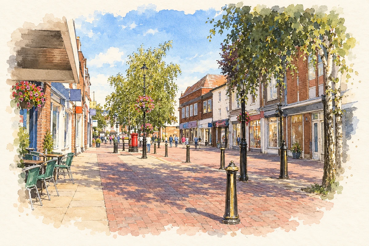
Watercolour and fine ink illustration of Bromsgrove townscape
Illustration · Bromsgrove townscape
History & heritage

Place & story

A street with depth behind it

Bromsgrove received weekly market rights in 1200. Its long main street and narrow plots preserve elements of the medieval town, overlooked by St John’s church on higher ground. The rear courts and passages matter as much as the street frontage: workshops developed behind houses and shops. [2]

Cloth manufacture was established by 1533, drawing on mills supplied by streams from the Lickey Hills. Linen and cloth remained important into the eighteenth century, alongside nailmaking from the seventeenth. Nails later became predominant, with button making another significant trade. Bromsgrove’s economy changed through overlapping manufactures rather than one industry simply replacing another. [2]

Nails made at home

Nailmaking was a household industry as well as an industrial business. The Heritage Lottery Fund’s account of a surviving Lickey End cottage describes a brick home with an attached single-storey workshop, and work involving men, women and children. Its small scale challenges any assumption that industrial labour happened only in large factories. [3]

In 2012 the fund supported Avoncroft Museum’s project to dismantle and rebuild that cottage. Records placed it in the same family from 1871 until 2008. Preserving the building offered a way to examine the relationship between cramped domestic accommodation and poorly rewarded work, rather than displaying tools without the household around them. [3]

Worcestershire Archaeology’s town-centre survey records the decline of hand nailmaking from the mid-nineteenth century as cheaper machine-made products competed with it. Other trades, including cloth, buttons, glass and brass founding, used purpose-built premises away from the main street. The town contained several different settings for manufacture. [4]

The railway and the hillside

The railway reached Bromsgrove in 1840, but its station stood about a mile from the town. New Road was built in 1865 to replace the steep, narrow Old Station Road. The railway changed the town’s pattern of movement and helped encourage expansion eastwards, rather than merely adding a stop beside the old market. [4]

North of the station, the Lickey Incline climbed towards the Midlands plateau. Opened in 1840, its roughly two-mile ascent required specialised banking engines to assist trains. This was a continuing operational task: locomotive crews and railway workshops had to manage the gradient long after the construction engineers had finished. [5]

Art becomes another trade

Walter Gilbert became headmaster of Bromsgrove School of Art in 1898, the year the Bromsgrove Guild of Applied Art was formed. Worcestershire Archives describes his aim as a commercial enterprise offering skilled craftspeople well-paid employment. Metal casting, woodwork, stained glass and embroidery belonged to the same ambitious project. [6]

Architectural metalwork became a speciality, with the Buckingham Palace gates commissioned in 1905. Museum records from Ironbridge also show that the Guild’s operations involved workshops elsewhere, coordinated from the main metalworks in Station Street, Bromsgrove. Its reputation was international, but its organisation had a specific local base. [6] [7]

Buildings with more than one life

At the Strand, 2 Stourbridge Road began as Cock Hall, a gentleman’s house built in 1701. It became the town’s first workhouse in 1723 and later a tannery. This succession of uses gives a single surviving building connections with private comfort, institutional poverty and manufacture. [2]

Back to contents
Lives connected to this place

Notable people

A. E. Housman: a Bromsgrove education

The poet and classical scholar A. E. Housman grew up in the Bromsgrove area and attended Bromsgrove School, where he studied Greek and Latin and won poetry prizes. The council’s Housman Trail identifies Perry Hall, later Housman Hall, as a childhood home. His connection is to family life and schooling here; the title A Shropshire Lad should not obscure that Worcestershire upbringing. [8] [9]

Walter Gilbert: connecting school and workshop

Gilbert’s appointment at the School of Art and the formation of the Guild in 1898 linked artistic education with paid craft production. His importance to Bromsgrove lies in creating and coordinating a business through which specialist makers could undertake decorative commissions far beyond the town. [6]

Back to contents
A chronology

Timeline

Bromsgrove through time

  1. 1200 — Weekly market rights are granted. [2]

  2. 1533 — Cloth manufacture is documented. [2]

  3. 1723 — Cock Hall becomes a workhouse. [2]

  4. 1840 — The railway and Lickey Incline open. [4] [5]

  5. 1865 — New Road improves the route between town and station. [4]

  6. 1898 — The Bromsgrove Guild is formed. [6]

  7. 1905 — The Guild receives the Buckingham Palace gates commission. [6]

  8. 2012 — Heritage funding supports rescue of a Lickey End nailer’s cottage. [3]

Back to contents

Population over time

Built-up area · Settlement · Census 2021

Bromsgrove

34,755people · 2021

Census 2021 population of the named settlement, using ONS built-up area boundaries.

Published census counts.

Sources: ONS: Towns and cities, characteristics of built-up areas, Census 2021 (Table 1c)

View population figures
Bromsgrove — census population
Census yearPopulation
202134,755
Sources and how to read this chart

Usual residents on 21 March 2021; published ONS count rounded to the nearest 5.. Boundary geography: December 2022 (E63003192).

Census 2021 population of the named settlement, using ONS built-up area boundaries.

ONS Table 1c rounds counts to the nearest 5 and suppresses counts below 10. Matched by exact settlement name or individually reviewed district-qualified name, with its coordinate strictly inside that same official BUA boundary. The 2022 BUA geography changed methodology and cannot be directly compared with 2011 BUAs. Contains OS data © Crown copyright and database right 2026. Contains National Statistics data © Crown copyright and database right 2026.

Source: ONS: Towns and cities, characteristics of built-up areas, Census 2021 (Table 1c). Open Government Licence v3.0. Retrieved 2026-10-26. Source: ONS and Ordnance Survey: Built Up Areas December 2022 GB BGG. Open Government Licence v3.0. Retrieved 2026-10-26.

Neighbourhood census context

These figures describe statistical neighbourhoods, which may cover part of a place or include neighbouring places.

Neighbourhood census area · 1971–2021

Bromsgrove 011

Population of the area containing the recorded point for Bromsgrove, not the whole place. This area may cover part of the place or include neighbours.

01.8k3.5k5.3k7k1971: 5,391 people19711981: 6,543 people19811991: 6,038 people19912001: 6,366 people20012011: 6,793 people20112021: 6,949 people2021

Includes harmonised historical census estimates.

Sources: ONS · Paul Norman

View population figures
Bromsgrove 011 — census population and harmonised historical estimates
Census yearPopulation
19715,391
19816,543
19916,038
20016,366
20116,793
20216,949
Sources and how to read this chart

Usual residents of the containing MSOA; this is local area context, not the population of the named settlement.. Boundary geography: 1 April 2022 (E02006706).

2011 and 2021 census counts harmonised by ONS to the same 1 April 2022 geography. Location matched to ONS 2021 MSOA polygons (full resolution, coastline clipped, V7). ONS exact-fit lookup marks this MSOA unchanged from 2011 (U); historical estimates use that same footprint.

1971–2011: Paul Norman harmonised historical estimates on 2011 MSOAs, rounded to whole residents (1971–1991 are modelled). 2021: ONS census count. The historical 2011 total can differ slightly from the ONS change-over-time 2011 total because of methodology and statistical disclosure controls. These are area estimates, not settlement totals.

Source: ONS Census change over time: usual resident population, 2011 and 2021. Open Government Licence v3.0. Retrieved 2026-10-26. Source: ONS MSOA December 2021 boundaries EW BFC V7. Open Government Licence v3.0. Retrieved 2026-10-26. Source: Paul Norman — Area characteristics: Great Britain 1971 to 2011. Creative Commons Attribution 4.0. Retrieved 2026-10-26. Source: ONS MSOA 2011 to MSOA 2021 exact-fit lookup for England and Wales. Open Government Licence v3.0. Retrieved 2026-10-26.

Recorded locationBromsgrove52.33523° N · 2.05928° WInteractive map loads when this area enters view.
Approximate recorded location · Geographic source

Geographic context

Place type
Town
Country / region
England · West Midlands
County group
Worcestershire
Current administration
Bromsgrove
Current administration
Worcestershire
Recorded coordinates
52.33523, -2.05928
OS Open Names ID
osgb4000000074567163

County groups are browsing aids. Current administrative and historic areas are recorded separately.

Recorded names

  • Bromsgrove · en · official

Nearby heritage

Distances are from the recorded place point. Proximity does not establish that a site lies within the place boundary or belongs to its history.

Sources & further reading

  1. OS Open Names October 2026 · Source licence.
  2. Bromsgrove Town Conservation Area Appraisal and Management Plan · Bromsgrove District Council
  3. Nailing Bromsgrove's world-beating past · National Lottery Heritage Fund
  4. The Historic Environment of Bromsgrove Town Centre: a baseline survey · Worcestershire Archaeology / Worcestershire County Council
  5. Lickey Incline · National Transport Trust
  6. Work begins to list the records of the Bromsgrove Guild · Worcestershire Archive & Archaeology Service
  7. Coalbrookdale Company orders of decorative and architectural ironwork · Ironbridge Gorge Museum Trust
  8. Housman Trail Guide · Bromsgrove District Council
  9. Bromsgrovians, issue 10, 2023–24 · Bromsgrove School
  10. Illustration of Bromsgrove townscape, adapted from Bromsgrove - geograph.org.uk - 49016.jpg by Chris McMillan. CC BY-SA 2.0. AI-assisted watercolour and fine ink adaptation; cream paper margins, simplified fine detail and removal of incidental street clutter.

Geographic source retrieved 2026-10-26. History last researched 2026-10-27. How this page was prepared.