Town

Droitwich Spa

Droitwich’s brine supported a long salt industry, then a bathing resort; archaeology and altered public spaces reveal how those identities overlapped.

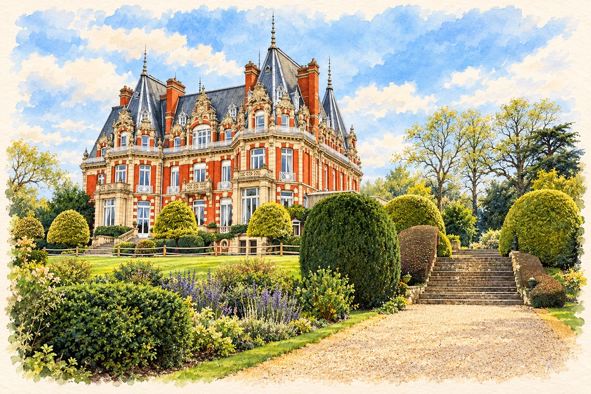
Watercolour and fine ink illustration of Chateau Impney, near Droitwich Spa
Illustration · Chateau Impney, near Droitwich Spa
History & heritage

Place & story

Work preserved beneath the town

Salt-making around Droitwich’s brine springs can be traced from the Iron Age. Waterlogged deposits preserve timber tanks, wells, hearths, drying vessels and organic material. Flood silts sealed layers of industrial waste and structures, allowing archaeologists to study changes in technology through unusually deep sequences. [2]

Roman timberwork, rope and barrels survive alongside later machinery. Production required control of springs and fuel, while river water had to be kept from diluting concentrated brine. [2]

Canals for a heavier trade

Expanding production increased the need for transport. After failed proposals to make the Salwarpe navigable, James Brindley surveyed a canal route to the Severn in 1767. An Act followed in 1768 and the Barge Canal opened in 1771. Its wide channel accommodated the local barges known as Wich boats. [3]

The discovery of brine at Stoke Prior in 1828 weakened Droitwich’s trading position. Railways arriving in 1841 and 1851 supplied further competition. The Junction Canal of 1854 attempted to renew waterborne trade by connecting to the Worcester and Birmingham Canal at Hanbury; its narrow locks used water-saving side ponds. [3]

Factory work and the spa economy

Nineteenth-century salt factories stood beside the canal for loading. Pumps raised brine into iron pipes supplying large evaporation pans, and whole families worked by day and night. Historic England records a production peak of about 120,000 tons in 1872. This was a labouring landscape, involving repeated handling, firing and loading rather than extraction alone. [2]

John Corbett consolidated salt production and moved much of it to Stoke Prior while promoting a different future for Droitwich. Wychavon’s conservation appraisal describes the resulting coexistence of hotel visitors and salt labourers. Spa development did not instantly replace industrial life: two sharply different experiences of the town overlapped. [4]

Corbett’s developments included Victoria Square, St Andrew’s Brine Baths, hotel accommodation and public amenities. The appraisal links these works to the new spa identity, while also noting street trees that remain part of the townscape. Buildings and landscaping helped make bathing a destination economy. [4]

Baths, offices and a heritage centre

St Richard’s House began as the entrance to St Andrew’s Brine Baths, opened in 1887. The town council dates the present black-and-white frontage to the 1930s. Behind it, treatment rooms and separate swimming baths for men and women organised the visitor experience. The building combines the memory of Victorian enterprise with later rebuilding. [5]

The baths closed in the 1970s and the entrance building became offices, with the rear entrances blocked. Renamed St Richard’s House, it has accommodated the Heritage and Information Centre since 1990. Its changing use brings the interpretation of salt-making into a former part of the spa business. [5]

Subsidence and a remade river corridor

Salt production in the town ended in 1922. Brine pumping had caused serious subsidence, still evident in High Street. During the 1930s remnants of factories and workers’ housing along the river and canal were cleared for Vines Park. Later road and shopping developments removed further buildings and portions of the old street layout. [4]

Archaeological remains outlasted much of the visible industry. Excavation in 1983–84 investigated the Upwhich brine well. At Gurneys Lane a surviving industrial pump and part of Salt House give the buried production landscape a visible presence. [2]

Back to contents
Lives connected to this place

Notable people

John Corbett: reshaping an industrial town

Corbett’s relationship to Droitwich was as salt entrepreneur and spa promoter. His legacy also included Salters Hall, a meeting place for salt workers on the site later occupied by the library. Linking that amenity with the baths keeps working households within the account of his patronage. [5]

Back to contents
A chronology

Timeline

Droitwich through time

  1. Iron Age onward — Archaeology records salt production around the springs. [2]

  2. 1771 — The Barge Canal opens. [3]

  3. 1854 — The Junction Canal opens towards Hanbury. [3]

  4. 1872 — Salt output reaches about 120,000 tons. [2]

  5. 1887 — St Andrew’s Brine Baths open. [5]

  6. 1922 — Salt production in Droitwich ends. [4]

  7. 1930s — Cleared industrial land becomes Vines Park. [4]

  8. 1990 — St Richard’s House becomes home to the heritage centre. [5]

Back to contents

Population over time

Built-up area · Settlement · Census 2021

Droitwich Spa

26,420people · 2021

Census 2021 population of the named settlement, using ONS built-up area boundaries.

Published census counts.

Sources: ONS: Towns and cities, characteristics of built-up areas, Census 2021 (Table 1c)

View population figures
Droitwich Spa — census population
Census yearPopulation
202126,420
Sources and how to read this chart

Usual residents on 21 March 2021; published ONS count rounded to the nearest 5.. Boundary geography: December 2022 (E63003350).

Census 2021 population of the named settlement, using ONS built-up area boundaries.

ONS Table 1c rounds counts to the nearest 5 and suppresses counts below 10. Matched by exact settlement name or individually reviewed district-qualified name, with its coordinate strictly inside that same official BUA boundary. The 2022 BUA geography changed methodology and cannot be directly compared with 2011 BUAs. Contains OS data © Crown copyright and database right 2026. Contains National Statistics data © Crown copyright and database right 2026.

Source: ONS: Towns and cities, characteristics of built-up areas, Census 2021 (Table 1c). Open Government Licence v3.0. Retrieved 2026-10-26. Source: ONS and Ordnance Survey: Built Up Areas December 2022 GB BGG. Open Government Licence v3.0. Retrieved 2026-10-26.

Neighbourhood census context

These figures describe statistical neighbourhoods, which may cover part of a place or include neighbouring places.

Neighbourhood census area · 1971–2021

Wychavon 003

Population of the area containing the recorded point for Droitwich Spa, not the whole place. This area may cover part of the place or include neighbours.

01.5k3k4.5k6k1971: 2,696 people19711981: 4,998 people19811991: 4,762 people19912001: 5,117 people20012011: 5,429 people20112021: 5,427 people2021

Includes harmonised historical census estimates.

Sources: ONS · Paul Norman

View population figures
Wychavon 003 — census population and harmonised historical estimates
Census yearPopulation
19712,696
19814,998
19914,762
20015,117
20115,429
20215,427
Sources and how to read this chart

Usual residents of the containing MSOA; this is local area context, not the population of the named settlement.. Boundary geography: 1 April 2022 (E02006750).

2011 and 2021 census counts harmonised by ONS to the same 1 April 2022 geography. Location matched to ONS 2021 MSOA polygons (full resolution, coastline clipped, V7). ONS exact-fit lookup marks this MSOA unchanged from 2011 (U); historical estimates use that same footprint.

1971–2011: Paul Norman harmonised historical estimates on 2011 MSOAs, rounded to whole residents (1971–1991 are modelled). 2021: ONS census count. The historical 2011 total can differ slightly from the ONS change-over-time 2011 total because of methodology and statistical disclosure controls. These are area estimates, not settlement totals.

Source: ONS Census change over time: usual resident population, 2011 and 2021. Open Government Licence v3.0. Retrieved 2026-10-26. Source: ONS MSOA December 2021 boundaries EW BFC V7. Open Government Licence v3.0. Retrieved 2026-10-26. Source: Paul Norman — Area characteristics: Great Britain 1971 to 2011. Creative Commons Attribution 4.0. Retrieved 2026-10-26. Source: ONS MSOA 2011 to MSOA 2021 exact-fit lookup for England and Wales. Open Government Licence v3.0. Retrieved 2026-10-26.

Recorded locationDroitwich Spa52.26809° N · 2.14570° WInteractive map loads when this area enters view.
Approximate recorded location · Geographic source

Geographic context

Place type
Town
Country / region
England · West Midlands
County group
Worcestershire
Current administration
Wychavon
Current administration
Worcestershire
Recorded coordinates
52.26809, -2.14570
OS Open Names ID
osgb4000000074567695

County groups are browsing aids. Current administrative and historic areas are recorded separately.

Recorded names

  • Droitwich Spa · en · official

Nearby heritage

Distances are from the recorded place point. Proximity does not establish that a site lies within the place boundary or belongs to its history.

Sources & further reading

  1. OS Open Names October 2026 · Source licence.
  2. Multi-period salt production remains in Droitwich: scheduled monument 1020256 · Historic England
  3. History of the Droitwich Canals · Canal & River Trust
  4. Droitwich Spa Conservation Area Appraisal · Wychavon District Council
  5. St Richard’s House · Droitwich Spa Town Council
  6. Illustration of Chateau Impney, near Droitwich Spa, adapted from Chateau Impney by Philip Halling. CC BY-SA 2.0. AI-assisted watercolour and fine ink adaptation; cream paper margins, simplified fine detail and removal of incidental street clutter.

Geographic source retrieved 2026-10-26. History last researched 2026-10-27. How this page was prepared.