A medieval priory anchors Great Malvern, where water treatment, railway visitors and scientific research successively found homes beneath the hills.
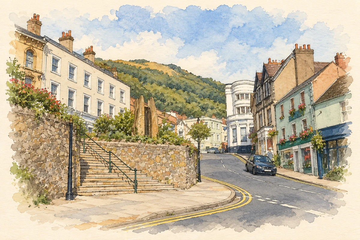
Illustration · Church Street, Great Malvern, with Elgar statue and Enigma Fountain
History & heritage
Place & story
A monastery becomes a parish church
The Priory’s own history places the start of building in 1085, following the Worcester Monastic Annals. Founded for thirty monks, it occupied land belonging to Westminster Abbey and became a dependent cell of that monastery. The Norman arcades survive within a much enlarged church, giving the town a visible connection with its monastic beginnings.[3]
During the fifteenth century the church was rebuilt with large windows, coloured glass, tiles and carved choir stalls. Its survival after the monastery surrendered in 1539 depended on local parishioners, who bought the church for £20. They gained a replacement for their dilapidated parish church, but struggled to afford the repairs: saving a building and maintaining it were different undertakings.[3]
Making a living from the waters
Malvern’s spring water had a reputation long before its Victorian fame. Richard Banister discussed it in 1622, and Dr John Wall analysed its low mineral content in 1756. The museum describes historical treatments involving drinking, washing and cold-water pouring. These were practices and beliefs of their time, rather than evidence that the advertised cures worked.[2]
Doctors James Wilson and James Gully established their water-cure practices in 1842. Visitors included the wealthy and famous, but the resort also made work for less privileged residents: women and children provided donkey rides on the hills, while demand encouraged bottled-water sales. By the late 1870s the cure was declining, after Wilson’s death, Gully’s departure and competition from continental resorts.[2]
A railway resort and a scientific refuge
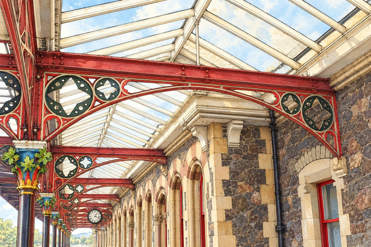
Completed in 1863, Great Malvern station was designed by E. W. Elmslie for a prosperous resort clientele. Its decorated iron columns and the covered route to the Imperial Hotel made arrival part of the visitor experience. The hotel later became a school, one example of the way buildings created for tourism found other uses.[4]
In 1942 government scientists arrived to develop radar. Schools, hotels and private homes accommodated hundreds of newcomers. The County Hotel, formerly Wilson’s hydropathic establishment, housed scientists and members of the Women’s Auxiliary Air Force. The same stock of large buildings that had served treatment and leisure could now support wartime research.[4]
Illustration · Great Malvern station canopy, after 2018 photographs; fine decorative details simplified
A musical institution beyond the spa
Malvern Concert Club began with a concert on 31 October 1903. Founded by Edward Elgar, it developed a continuing programme of chamber music, bringing performers to the town rather than relying only on the fame of past visitors. Its own account records at least one concert in every year since its foundation, including adapted performances during the coronavirus pandemic.[5]
Elgar was living in Malvern when he founded the Concert Club. The local architect Arthur Troyte Griffith, his friend and the subject of the seventh Enigma Variation, served as its first secretary for more than thirty-eight years. Their connection joins composition with the practical work of organising local musical life.[5]
James Wilson: a doctor shaping the town
Wilson helped establish the water cure in 1842. Around 1848 he built the central part of the later County Hotel for patients. His influence can therefore be traced through both treatment and the buildings that housed it; those rooms later accommodated people working on a very different form of applied science.[4][2]
These figures describe statistical neighbourhoods, which may cover part of a place or include neighbouring places.
Neighbourhood census area · 1971–2021
Malvern Hills 010
Population of the area containing the recorded point for Great Malvern, not the whole place. This area may cover part of the place or include neighbours.
Malvern Hills 010 — census population and harmonised historical estimates
Census year
Population
1971
6,973
1981
6,639
1991
7,649
2001
7,102
2011
7,260
2021
7,404
Sources and how to read this chart
Usual residents of the containing MSOA; this is local area context, not the population of the named settlement.. Boundary geography: 1 April 2022 (E02006719).
2011 and 2021 census counts harmonised by ONS to the same 1 April 2022 geography. Location matched to ONS 2021 MSOA polygons (full resolution, coastline clipped, V7). ONS exact-fit lookup marks this MSOA unchanged from 2011 (U); historical estimates use that same footprint.
1971–2011: Paul Norman harmonised historical estimates on 2011 MSOAs, rounded to whole residents (1971–1991 are modelled). 2021: ONS census count. The historical 2011 total can differ slightly from the ONS change-over-time 2011 total because of methodology and statistical disclosure controls. These are area estimates, not settlement totals.
Illustration of Church Street, Great Malvern, with Elgar statue and Enigma Fountain, adapted from The top of Church Street. - geograph.org.uk - 56973.jpg by Bob Embleton. CC BY-SA 2.0. AI-assisted watercolour and fine ink adaptation; cream paper margins, simplified fine detail and removal of incidental street clutter.
Illustration of Great Malvern railway station canopy, adapted from Platform 1 canopy at Great Malvern station, 2 November 2018 by Geof Sheppard. CC BY-SA 4.0. AI-assisted watercolour and fine ink adaptation combining the canopy view and its capital detail. Weathering, distant botanical capitals and fine carvings simplified. This is an illustration of surviving features, not a measured documentary record or a Victorian reconstruction. Adaptation shared under CC BY-SA 4.0. Additional reference: Platform 1 canopy support, 2 November 2018 by Geof Sheppard, CC BY-SA 4.0.
 place