Town

Kidderminster

Carpet factories transformed a town with older textile traditions. A surviving mill, public park and railway terminus reveal how manufacturing wealth, working skills and later conservation shaped Kidderminster.

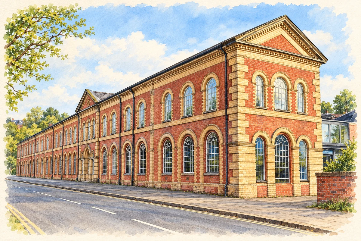
Watercolour and fine ink illustration of Stour Vale Mill, Kidderminster
Illustration · Stour Vale Mill, Kidderminster
History & heritage

Place & story

From cloth to carpets

Kidderminster’s textile history did not begin with carpets. It produced woollen cloth in the seventeenth century before carpet manufacture developed in the eighteenth. By the middle of the nineteenth century it had become a factory town. The Brinton family entered carpet production in the late eighteenth century, part of the change from an older textile centre to a town identified with a particular finished product. [5]

The scale of that dependence became striking. The Museum of Carpet’s curatorial brief records twenty-five companies and more than 15,000 people earning their living in the industry during the 1960s. These are employment figures for the carpet trade, not a census total for the town. They indicate how a single industry could support a wide network of households. [2]

Boom, contraction and a decision to collect

The museum’s account places the following contraction in the 1970s, when overseas competition and changing tastes weakened the industry. A manufacturing town’s skills and buildings could outlast the market that had supported them. This change created a second problem alongside lost work: machinery and company records were vulnerable as businesses contracted or closed. [2] [4]

The Carpet Museum Trust was founded in 1981. It collected equipment, archives and libraries from local firms, preserving business ledgers, minutes, deeds and accounts alongside machines. A collection of around three thousand carpet designs included work by Charles Voysey, Edouard Glorget and Bernat Klein. This was a record of design and business organisation as well as industrial technology. [4]

A mill holds the evidence

Stour Vale Mill was a carpet factory from 1855 until 2007. The Museum of Carpet opened there in 2012, occupying former offices and warehouse space. The change of use gives visitors a direct link to a workplace without presenting the entire surviving complex as an untouched factory interior. [3]

The museum combines an archive and library with galleries and working looms. These forms of evidence answer different questions: a machine helps explain production, a pattern records design decisions, and a company ledger reveals how a business organised itself. Preserving them together makes it possible to connect the finished carpet with the people and systems behind it. [3] [4]

Space for a growing town

Brinton Park brings another part of the industrial town into view. Council research records that the land had formed part of Sutton Common before 1882, that the park was laid out in 1886 and that it was given to the people of Kidderminster in 1887. The sequence distinguishes preparing the landscape from its public gift. Leisure space became part of the town’s shared inheritance alongside its factories. [8]

A new station in an old railway tradition

Kidderminster Town station looks older than it is. The Severn Valley Railway describes its building as a mid-1980s recreation of a Great Western station of the early twentieth century. Nearby, the railway museum occupies an original warehouse built in 1878. The two buildings preserve railway history in different ways: one through reuse, the other through a consciously historical design. [7]

The first heritage train left Kidderminster Town on 30 July 1984. Extending the preserved line here created a sixteen-mile route to Bridgnorth and improved access from the national railway next door. At first the terminus lacked its main station building. The familiar ensemble grew after the service began, making preservation a continuing construction project. [6]

Back to contents
Lives connected to this place

Notable people

Richard Baxter: ministry and public memory

Richard Baxter’s connection was a working ministry in seventeenth-century Kidderminster, rather than a birthplace association. The town commemorated him in Thomas Brock’s white-marble statue of 1875, standing on a granite pedestal. Formerly placed in the Bull Ring, the monument is itself evidence of how a later industrial town chose to remember an earlier religious figure. [9]

Rowland Hill: a birthplace with a wider legacy

Postal reformer Rowland Hill was born in Kidderminster on 3 December 1795, as the opening chapter of his biography records. His most influential work belonged to a national debate: from 1837 he argued for inexpensive, uniform postage paid in advance and charged by weight. The proposals helped produce the reforms made law in 1839. The local relationship is his birth, while the achievement concerns a communications system reaching far beyond the town. [10] [11]

Back to contents
A chronology

Timeline

Kidderminster through time

  1. Seventeenth century — Woollen-cloth production precedes the carpet industry. [5]

  2. 1641 — Richard Baxter begins his ministry in Kidderminster. [9]

  3. Eighteenth century — Carpet manufacture develops, with the Brintons entering production later in the century. [5]

  4. 3 December 1795 — Rowland Hill is born in the town. [10]

  5. 1855 — Stour Vale Mill begins its working life as a carpet factory. [3]

  6. 1887 — Brinton Park is given to the people of Kidderminster. [8]

  7. 1981 — The Carpet Museum Trust is founded. [4]

  8. 30 July 1984 — Heritage passenger services begin from Kidderminster Town station. [6]

  9. 2007 / 2012 — Carpet production at Stour Vale Mill ends; the Museum of Carpet subsequently opens there. [3]

Back to contents

Population over time

Built-up area · Settlement · Census 2021

Kidderminster

57,560people · 2021

Census 2021 population of the named settlement, using ONS built-up area boundaries.

Published census counts.

Sources: ONS: Towns and cities, characteristics of built-up areas, Census 2021 (Table 1c)

View population figures
Kidderminster — census population
Census yearPopulation
202157,560
Sources and how to read this chart

Usual residents on 21 March 2021; published ONS count rounded to the nearest 5.. Boundary geography: December 2022 (E63003049).

Census 2021 population of the named settlement, using ONS built-up area boundaries.

ONS Table 1c rounds counts to the nearest 5 and suppresses counts below 10. Matched by exact settlement name or individually reviewed district-qualified name, with its coordinate strictly inside that same official BUA boundary. The 2022 BUA geography changed methodology and cannot be directly compared with 2011 BUAs. Contains OS data © Crown copyright and database right 2026. Contains National Statistics data © Crown copyright and database right 2026.

Source: ONS: Towns and cities, characteristics of built-up areas, Census 2021 (Table 1c). Open Government Licence v3.0. Retrieved 2026-10-26. Source: ONS and Ordnance Survey: Built Up Areas December 2022 GB BGG. Open Government Licence v3.0. Retrieved 2026-10-26.

Neighbourhood census context

These figures describe statistical neighbourhoods, which may cover part of a place or include neighbouring places.

Neighbourhood census area · 1971–2021

Wyre Forest 004

Population of the area containing the recorded point for Kidderminster, not the whole place. This area may cover part of the place or include neighbours.

02.3k4.5k6.8k9k1971: 5,125 people19711981: 5,820 people19811991: 6,216 people19912001: 6,115 people20012011: 7,202 people20112021: 8,380 people2021

Includes harmonised historical census estimates.

Sources: ONS · Paul Norman

View population figures
Wyre Forest 004 — census population and harmonised historical estimates
Census yearPopulation
19715,125
19815,820
19916,216
20016,115
20117,202
20218,380
Sources and how to read this chart

Usual residents of the containing MSOA; this is local area context, not the population of the named settlement.. Boundary geography: 1 April 2022 (E02006770).

2011 and 2021 census counts harmonised by ONS to the same 1 April 2022 geography. Location matched to ONS 2021 MSOA polygons (full resolution, coastline clipped, V7). ONS exact-fit lookup marks this MSOA unchanged from 2011 (U); historical estimates use that same footprint.

1971–2011: Paul Norman harmonised historical estimates on 2011 MSOAs, rounded to whole residents (1971–1991 are modelled). 2021: ONS census count. The historical 2011 total can differ slightly from the ONS change-over-time 2011 total because of methodology and statistical disclosure controls. These are area estimates, not settlement totals.

Source: ONS Census change over time: usual resident population, 2011 and 2021. Open Government Licence v3.0. Retrieved 2026-10-26. Source: ONS MSOA December 2021 boundaries EW BFC V7. Open Government Licence v3.0. Retrieved 2026-10-26. Source: Paul Norman — Area characteristics: Great Britain 1971 to 2011. Creative Commons Attribution 4.0. Retrieved 2026-10-26. Source: ONS MSOA 2011 to MSOA 2021 exact-fit lookup for England and Wales. Open Government Licence v3.0. Retrieved 2026-10-26.

Recorded locationKidderminster52.38820° N · 2.24923° WInteractive map loads when this area enters view.
Approximate recorded location · Geographic source

Geographic context

Place type
Town
Country / region
England · West Midlands
County group
Worcestershire
Current administration
Wyre Forest
Current administration
Worcestershire
Recorded coordinates
52.38820, -2.24923
OS Open Names ID
osgb4000000074568044

County groups are browsing aids. Current administrative and historic areas are recorded separately.

Recorded names

  • Kidderminster · en · official

Nearby heritage

Explore recorded heritage in Kidderminster and the surrounding area. This selection is based on proximity to a recorded settlement point; it is not a complete inventory or evidence that a site lies within the settlement or belongs to its history.

Heritage locationsKidderminster & surrounding areaInteractive map loads when this area enters view. Source records are listed below.

Numbered markers match the source records below. Locations are recorded reference points, not site boundaries.

  1. GATE PIERS TO NEW MEETING HOUSE · Listed building
  2. THE MEDICAL HALL · Listed building
  3. 2 AND 3, CHURCH STREET · Listed building
  4. 4, CHURCH STREET · Listed building
  5. MIDLAND BANK · Listed building
  6. LLOYDS BANK · Listed building
  7. 5 AND 6, CHURCH STREET · Listed building
  8. 30, CHURCH STREET · Listed building

Sources & further reading

  1. OS Open Names October 2026 · Source licence.
  2. Curatorial Consultant Brief (2016) · Museum of Carpet
  3. Museum Access Statement · Museum of Carpet
  4. Our History · Museum of Carpet
  5. Made in Kidderminster: the History of the Carpet Industry · Gay Hill and Malcolm Dick / Revolutionary Players
  6. 40 years for Kidderminster Town station · Severn Valley Railway
  7. Kidderminster Station · Severn Valley Railway
  8. Brinton Park Business Plan (2020), section 2 · Wyre Forest District Council
  9. The Baxter Monument: list entry1100091 · Historic England
  10. The Life of Sir Rowland Hill and the History of Penny Postage, vol1 · Rowland Hill and George Birkbeck Hill
  11. Postal Reforms that Transformed the Mail · Smithsonian National Postal Museum
  12. Illustration of Stour Vale Mill, Kidderminster, adapted from Kidderminster Museum of Carpet by Philip Halling. CC BY-SA 2.0. AI-assisted watercolour and fine ink adaptation; cream paper margins, simplified fine detail and removal of incidental street clutter.

Geographic source retrieved 2026-10-26. History last researched 2026-10-26. How this page was prepared.