Village

Ombersley

Ombersley’s timber-framed centre, designed park and parish institutions show how village life developed around a crossroads and a powerful landed estate.

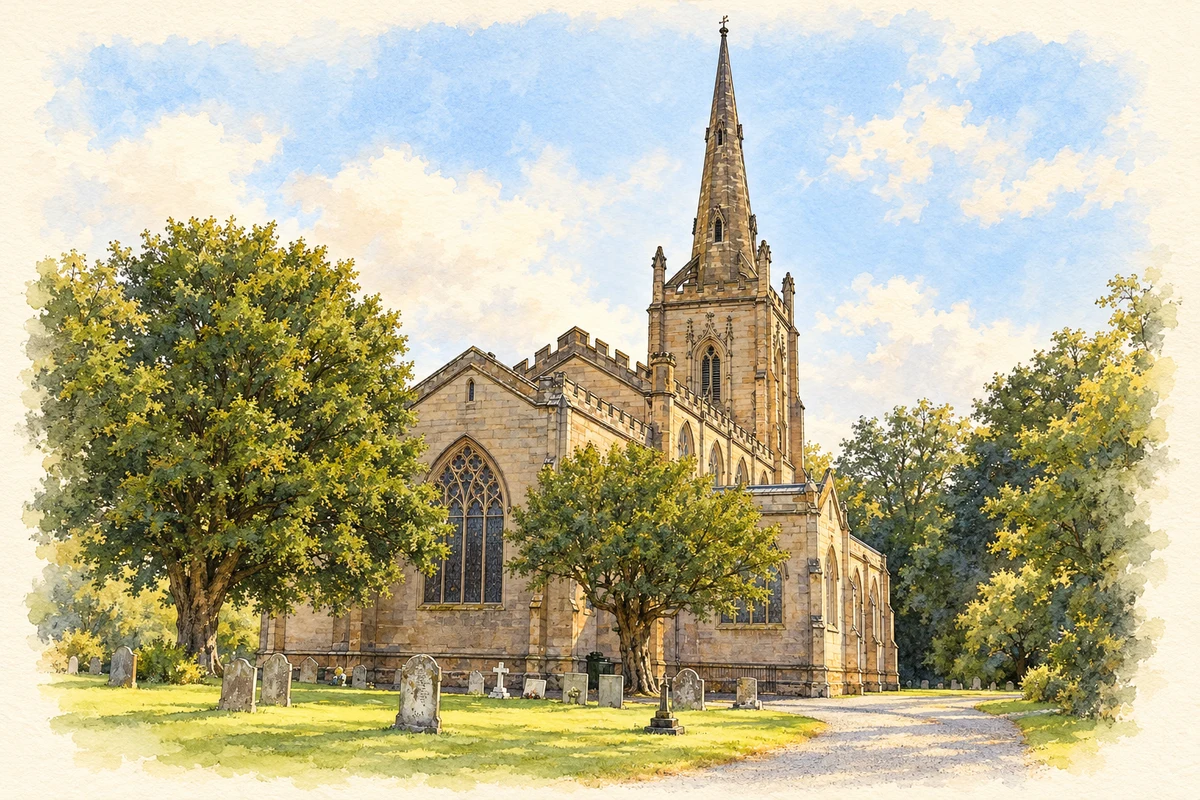
Watercolour and fine ink illustration of St Andrew’s Church, Ombersley
Illustration · St Andrew’s Church, Ombersley
History & heritage

Place & story

A crossroads serving an agricultural estate

Ombersley developed where routes between Worcester and Kidderminster met those towards Hadley and Droitwich. The abbots of Evesham administered their estate from buildings on the site of the later Court. Fertile land supplied crops, grazing and revenue; the village’s position connected that rural production to people and goods moving through the crossroads. [3]

A weekly market and annual fair were granted to the abbots in 1354. The relationship between landholding and trade remained visible long afterwards. By the early nineteenth century the village supported schools, inns, shops and crafts, including blacksmiths and carpenters. Former shop windows, stable buildings and the Old School House record uses that have since changed. [3]

A house and park repeatedly remade

The Sandys family succeeded the abbots as owners of the Court estate. In the eighteenth century Francis Smith of Warwick designed a replacement house for the first Lord Sandys. The later remodelling was broader: Mary, Marchioness of Downshire, selected John Webb to alter house, stables and park. A letter of 1812 records landscaping underway. [2]

Webb removed the earlier wings, refaced the house and created new approaches, lawns and planting. The pools had served an adjacent mill; reshaping them made water part of the designed scenery. The park therefore preserves a relationship between utility and display, rather than a landscape created without an earlier working history. [2]

Two churches in one churchyard

St Andrew’s was completed in 1829 to Thomas Rickman’s design. Its medieval Gothic forms belong to a nineteenth-century building: the parish describes a high stone-vaulted ceiling and stained-glass windows. The chancel of the older church survives beside it as the Sandys mausoleum. Parish worship and family remembrance thus occupy neighbouring buildings of different dates. [4]

The church’s continuing use has required substantial repairs. Its tower restoration was completed in 2011 with English Heritage and community support; a long programme of window repairs concluded in 2022. These projects connect preservation to donations and local effort, as well as to the original patron’s investment. [4]

An educational charity beyond the village

Richard Lloyd, a churchwarden living at Comhampton, worked with Sir Samuel Sandys on a scheme to educate parish children. Their foundation was established in 1723, supported by land income, bequests and estate assistance. Nine trustees included the lord of the manor and the vicar. Education was organised through a combination of private resources and parish office. [5]

The first school opened at Brookhampton in 1729; schools also followed in Ombersley village. The charity’s original arrangements provided free teaching for children whose parents’ property fell below a specified rateable value. This was provision directed towards poorer households, before government schooling, across a parish larger than the village centre. [5]

Back to contents
Lives connected to this place

Notable people

Mary, Marchioness of Downshire: reshaping the estate

Mary inherited the estate in 1797 and became Baroness Sandys in her own right in 1802. Her local importance rests on commissioning the Court’s transformation and contributing towards the new church, while retaining the old chancel for her family. These choices affected the village’s setting as well as the house itself. [2]

Richard Lloyd: education as a local legacy

Lloyd’s local tie was to Comhampton within the parish, rather than residence in Ombersley’s village centre. His educational scheme helped establish a durable source of support for parish children. The distinction matters in a story whose institutions served surrounding settlements as well as the crossroads community. [5]

Back to contents
A chronology

Timeline

Ombersley through time

  1. 1354 — The abbots receive market and fair rights. [3]

  2. 1723 — Richard Lloyd’s educational foundation is established. [5]

  3. 1729 — The foundation’s first school opens at Brookhampton. [5]

  4. 1812 — A letter records work underway on the Court’s park. [2]

  5. 1829 — Rickman’s new St Andrew’s is completed. [4]

  6. 2011 — Restoration of the church tower is completed. [4]

Back to contents

Population over time

Built-up area · Settlement · Census 2021

Ombersley

600people · 2021

Census 2021 population of the named settlement, using ONS built-up area boundaries.

Published census counts.

Sources: ONS: Towns and cities, characteristics of built-up areas, Census 2021 (Table 1c)

View population figures
Ombersley — census population
Census yearPopulation
2021600
Sources and how to read this chart

Usual residents on 21 March 2021; published ONS count rounded to the nearest 5.. Boundary geography: December 2022 (E63003320).

Census 2021 population of the named settlement, using ONS built-up area boundaries.

ONS Table 1c rounds counts to the nearest 5 and suppresses counts below 10. Matched by exact settlement name or individually reviewed district-qualified name, with its coordinate strictly inside that same official BUA boundary. The 2022 BUA geography changed methodology and cannot be directly compared with 2011 BUAs. Contains OS data © Crown copyright and database right 2026. Contains National Statistics data © Crown copyright and database right 2026.

Source: ONS: Towns and cities, characteristics of built-up areas, Census 2021 (Table 1c). Open Government Licence v3.0. Retrieved 2026-10-26. Source: ONS and Ordnance Survey: Built Up Areas December 2022 GB BGG. Open Government Licence v3.0. Retrieved 2026-10-26.

Neighbourhood census context

These figures describe statistical neighbourhoods, which may cover part of a place or include neighbouring places.

Neighbourhood census area · 1971–2021

Wychavon 006

Population of the area containing the recorded point for Ombersley, not the whole place. This area may cover part of the place or include neighbours.

02k4k6k8k1971: 5,437 people19711981: 4,926 people19811991: 5,216 people19912001: 5,685 people20012011: 6,300 people20112021: 7,385 people2021

Includes harmonised historical census estimates.

Sources: ONS · Paul Norman

View population figures
Wychavon 006 — census population and harmonised historical estimates
Census yearPopulation
19715,437
19814,926
19915,216
20015,685
20116,300
20217,385
Sources and how to read this chart

Usual residents of the containing MSOA; this is local area context, not the population of the named settlement.. Boundary geography: 1 April 2022 (E02006753).

2011 and 2021 census counts harmonised by ONS to the same 1 April 2022 geography. Location matched to ONS 2021 MSOA polygons (full resolution, coastline clipped, V7). ONS exact-fit lookup marks this MSOA unchanged from 2011 (U); historical estimates use that same footprint.

1971–2011: Paul Norman harmonised historical estimates on 2011 MSOAs, rounded to whole residents (1971–1991 are modelled). 2021: ONS census count. The historical 2011 total can differ slightly from the ONS change-over-time 2011 total because of methodology and statistical disclosure controls. These are area estimates, not settlement totals.

Source: ONS Census change over time: usual resident population, 2011 and 2021. Open Government Licence v3.0. Retrieved 2026-10-26. Source: ONS MSOA December 2021 boundaries EW BFC V7. Open Government Licence v3.0. Retrieved 2026-10-26. Source: Paul Norman — Area characteristics: Great Britain 1971 to 2011. Creative Commons Attribution 4.0. Retrieved 2026-10-26. Source: ONS MSOA 2011 to MSOA 2021 exact-fit lookup for England and Wales. Open Government Licence v3.0. Retrieved 2026-10-26.

Recorded locationOmbersley52.27113° N · 2.22891° WInteractive map loads when this area enters view.
Approximate recorded location · Geographic source

Geographic context

Place type
Village
Country / region
England · West Midlands
County group
Worcestershire
Current administration
Wychavon
Current administration
Worcestershire
Recorded coordinates
52.27113, -2.22891
OS Open Names ID
osgb4000000074565750

County groups are browsing aids. Current administrative and historic areas are recorded separately.

Recorded names

  • Ombersley · en · official

Nearby heritage

Distances are from the recorded place point. Proximity does not establish that a site lies within the place boundary or belongs to its history.

Sources & further reading

  1. OS Open Names October 2026 · Source licence.
  2. Ombersley Court, registered landscape1439026 · Historic England
  3. Ombersley Conservation Area Appraisal,June2005 · Wychavon District Council
  4. About Us:St Andrew’s,Ombersley · St Andrew’s Parochial Church Council
  5. Lloyds Educational Foundation · Lloyds Educational Foundation / All About Ombersley & Doverdale
  6. Illustration of St Andrew’s Church, Ombersley, adapted from St Andrew’s Church, Ombersley - geograph.org.uk - 2037375.jpg by Richard Rogerson. CC BY-SA 2.0. AI-assisted watercolour and fine ink adaptation; cream paper margins, simplified fine detail and removal of incidental street clutter.

Geographic source retrieved 2026-10-26. History last researched 2026-10-27. How this page was prepared.