Town

Redditch

Monks reshaped the Arrow Valley, needle makers organised specialised work, and twentieth-century planners built a larger town around an inherited landscape.

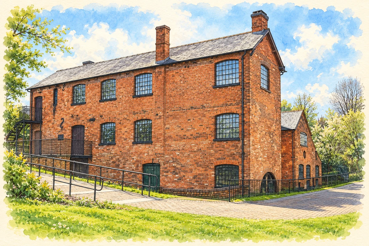
Watercolour and fine ink illustration of Forge Mill Needle Museum, Redditch
Illustration · Forge Mill Needle Museum, Redditch
History & heritage

Place & story

Making an abbey landscape

Bordesley Abbey began with a grant of land in the Arrow Valley in 1140 to Cistercian monks from Garendon in Leicestershire. The museum’s account describes a marshy site made usable by drainage and diversion of the river. Early wooden buildings gave way to stone. The surviving remains show more than a religious community choosing a secluded location: its occupants actively remade the landscape to support a large institution. [4]

The abbey’s wealth came from an estate of roughly twenty granges in Worcestershire and Warwickshire, producing cereals and especially wool. Its dissolution in 1538 ended monastic occupation, and buildings were demolished and estates sold. Excavation began in 1864 and resumed as a sustained project in 1969. Archaeology brought the valley’s earlier organisation back into view as modern Redditch was expanding. [4]

A small product, many processes

Needles made Redditch a specialised manufacturing centre. Forge Mill preserves the water-powered scouring stage, in which needles were cleaned and polished, together with much of its Victorian machinery. The building makes the finishing process visible in its original workshop setting. Needle cases, company photographs and displays of needles and fishhooks connect the machinery with the products that local firms sent into wider markets. [2]

The British Needle Company archive shows how many operations lay behind a simple finished needle. Pointing shaped the ends; stamping formed the eyes and eyeing punched through them. Heading removed surplus metal, followed by grinding, hardening, tempering and scouring. Inspection, weighing and wrapping completed a sequence that also required packaging workshops and distribution. Manufacture depended on organised stages of work rather than one worker making an entire object. [3]

Workers in the archive

Two photographic albums rescued by a former British Needle Company employee eventually reached the museum through historian Alan Foxall and the Friends of Forge Mill. Their images cover the 1920s to the 1960s, naming workers and showing their jobs. Grouping photographs by process lets readers compare machinery and working arrangements across decades. The archive preserves the people of the factory as well as its equipment. [3]

The museum interprets industrial life through several forms of evidence: the scouring workshop, surviving machinery, photographs and objects marketed by manufacturers. Those sources have different strengths. A machine explains movement and power; a labelled photograph can identify who performed a task. Together they give a more specific account of work than a reputation for needle-making alone. [2] [3]

Planning homes, employment and open space

Redditch was designated a New Town in April 1964 to help meet housing and employment needs in the Birmingham area. The Development Corporation aimed to enable residents to work locally, provide shops and social facilities, and integrate new development with the existing settlement. Open space was part of that programme. The intended town was a planned community with employment and services as well as additional homes. [5]

The planning process also investigated what was already there. Archaeological features were recorded and historic buildings surveyed; field boundaries, veteran trees and older structures could influence the new layout. Preservation was selective and contested. Freddie Charles’s survey warned against demolition without examining the buildings and possibilities for keeping them. Some farms were lost, while other buildings survived wholly or in part. The resulting landscape includes decisions about inheritance as well as new construction. [6]

The Development Corporation was wound up on 31 March 1985. Its work left a town whose twentieth-century form differed greatly from the earlier industrial settlement. The corporation’s stated aims link housing to local work, recreation and everyday services; that combination is central to understanding the scale of change, rather than viewing the expansion simply as a collection of housing estates. [5]

Back to contents
Lives connected to this place

Notable people

Freddie Charles: recording buildings before change

Timber-building specialist F. W. B. “Freddie” Charles surveyed historic buildings in the eastern New Town area for the Development Corporation. Commissioned by chief architect and planning officer Brian Bunch, his report was dated 13 March 1969. His sketches and assessments made older farmhouses part of the planning record. Redditch’s connection with Charles rests on this specific professional work, preserved in the county archive. [6]

John Bonham: a musical connection

Led Zeppelin drummer John Bonham was born in Redditch in 1948. His association is commemorated through public art in the town centre. A 2017 planning application proposed a work celebrating his life in Mercian Square, and evidence submitted to a later council committee records installation of the bronze memorial on 31 May 2018, his seventieth birthday. A local birthplace became a focus for remembrance shared by his family and fans. [7] [9] [8]

Back to contents
A chronology

Timeline

Redditch through time

  1. 1140 — Cistercian monks receive land to establish Bordesley Abbey. [4]

  2. 1538 — Bordesley Abbey is dissolved. [4]

  3. 1864 — J. M. Woodward begins excavating the abbey ruins. [4]

  4. April 1964 — Redditch is designated a New Town. [5]

  5. 1969 — Freddie Charles completes his historic-building survey; the Bordesley excavation project begins. [6] [4]

  6. 31 March 1985 — The Development Corporation is wound up. [5]

  7. 31 May 2018 — The John Bonham memorial is installed in the town centre. [8]

Back to contents

Population over time

Built-up area · Settlement · Census 2021

Redditch

81,635people · 2021

Census 2021 population of the named settlement, using ONS built-up area boundaries.

Published census counts.

Sources: ONS: Towns and cities, characteristics of built-up areas, Census 2021 (Table 1c)

View population figures
Redditch — census population
Census yearPopulation
202181,635
Sources and how to read this chart

Usual residents on 21 March 2021; published ONS count rounded to the nearest 5.. Boundary geography: December 2022 (E63003268).

Census 2021 population of the named settlement, using ONS built-up area boundaries.

ONS Table 1c rounds counts to the nearest 5 and suppresses counts below 10. Matched by exact settlement name or individually reviewed district-qualified name, with its coordinate strictly inside that same official BUA boundary. The 2022 BUA geography changed methodology and cannot be directly compared with 2011 BUAs. Contains OS data © Crown copyright and database right 2026. Contains National Statistics data © Crown copyright and database right 2026.

Source: ONS: Towns and cities, characteristics of built-up areas, Census 2021 (Table 1c). Open Government Licence v3.0. Retrieved 2026-10-26. Source: ONS and Ordnance Survey: Built Up Areas December 2022 GB BGG. Open Government Licence v3.0. Retrieved 2026-10-26.

Neighbourhood census context

These figures describe statistical neighbourhoods, which may cover part of a place or include neighbouring places.

Neighbourhood census area · 1971–2021

Redditch 004

Population of the area containing the recorded point for Redditch, not the whole place. This area may cover part of the place or include neighbours.

02k4k6k8k1971: 5,322 people19711981: 4,884 people19811991: 5,846 people19912001: 5,792 people20012011: 6,924 people20112021: 7,020 people2021

Includes harmonised historical census estimates.

Sources: ONS · Paul Norman

View population figures
Redditch 004 — census population and harmonised historical estimates
Census yearPopulation
19715,322
19814,884
19915,846
20015,792
20116,924
20217,020
Sources and how to read this chart

Usual residents of the containing MSOA; this is local area context, not the population of the named settlement.. Boundary geography: 1 April 2022 (E02006724).

2011 and 2021 census counts harmonised by ONS to the same 1 April 2022 geography. Location matched to ONS 2021 MSOA polygons (full resolution, coastline clipped, V7). ONS exact-fit lookup marks this MSOA unchanged from 2011 (U); historical estimates use that same footprint.

1971–2011: Paul Norman harmonised historical estimates on 2011 MSOAs, rounded to whole residents (1971–1991 are modelled). 2021: ONS census count. The historical 2011 total can differ slightly from the ONS change-over-time 2011 total because of methodology and statistical disclosure controls. These are area estimates, not settlement totals.

Source: ONS Census change over time: usual resident population, 2011 and 2021. Open Government Licence v3.0. Retrieved 2026-10-26. Source: ONS MSOA December 2021 boundaries EW BFC V7. Open Government Licence v3.0. Retrieved 2026-10-26. Source: Paul Norman — Area characteristics: Great Britain 1971 to 2011. Creative Commons Attribution 4.0. Retrieved 2026-10-26. Source: ONS MSOA 2011 to MSOA 2021 exact-fit lookup for England and Wales. Open Government Licence v3.0. Retrieved 2026-10-26.

Recorded locationRedditch52.30693° N · 1.94152° WInteractive map loads when this area enters view.
Approximate recorded location · Geographic source

Geographic context

Place type
Town
Country / region
England · West Midlands
County group
Worcestershire
Current administration
Redditch
Current administration
Worcestershire
Recorded coordinates
52.30693, -1.94152
OS Open Names ID
osgb4000000074547965

County groups are browsing aids. Current administrative and historic areas are recorded separately.

Recorded names

  • Redditch · en · official

Nearby heritage

Distances are from the recorded place point. Proximity does not establish that a site lies within the place boundary or belongs to its history.

Sources & further reading

  1. OS Open Names October 2026 · Source licence.
  2. Forge Mill Needle Museum · Forge Mill Needle Museum
  3. British Needle Company Archives · Forge Mill Needle Museum
  4. Bordesley Abbey · Forge Mill Needle Museum
  5. Redditch New Town profile · Town and Country Planning Association
  6. The Charles Archive: Old Buildings in a New Town · Worcestershire Archive & Archaeology Service
  7. About Redditch and Tourist Information · Redditch Borough Council
  8. Overview and Scrutiny Committee papers,23 June2022 · Redditch Borough Council
  9. Application17/00764/FUL, Mercian Square · Redditch Borough Council
  10. Illustration of Forge Mill Needle Museum, Redditch, adapted from Needle Mill Museum-Redditch by Colin Babb. CC BY-SA 2.0. AI-assisted watercolour and fine ink adaptation; cream paper margins, simplified fine detail and removal of incidental street clutter.

Geographic source retrieved 2026-10-26. History last researched 2026-10-27. How this page was prepared.