Town

Stourport-on-Severn

Canal basins created a town of warehouses, workshops and Georgian streets. Its trading families also built places of worship, while river recreation gave the working waterfront another life.

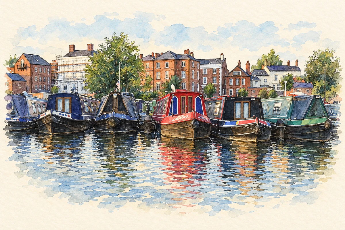
Watercolour and fine ink illustration of Canal boats at Stourport Basin
Illustration · Canal boats at Stourport Basin
History & heritage

Place & story

Where two kinds of boat met

Stourport grew at the transfer point between the Staffordshire and Worcestershire Canal and the Severn. Narrowboats delivered coal and manufactured goods to river-going trows. Warehouses, inns, boatbuilding, tanneries, ironworks and mills followed: the port required storage and workers to handle, repair and manufacture goods. [4]

The canal received parliamentary authority in 1766. Its southern reach opened to the Severn in 1771, with the northern section following in 1772. Connections to the Birmingham and Stourbridge canals widened its traffic. The dates describe stages in a developing network, rather than a single opening of every part. [4]

A growing town beside older Mitton

The terminus occupied land beside Lower Mitton, rather than an entirely empty district. Stourport Forward records cargoes ranging from pottery and bricks to farm produce. Five basins had been constructed by 1812, giving the waterfront a scale that explains the town’s rapid development around it. [3]

Industry remained close to its transport. The Baldwin family’s ironworks stood beside the canal, allowing products to leave by boat. Foundries, carpet production, tanning and vinegar manufacture gave Stourport a working life extending beyond the transshipment of other places’ goods. [3]

Streets looking towards the shipping

The council’s town trail describes Georgian houses on New Street that once looked down towards shipping on the river. York Street occupies a terrace above the basins, while High Street combines shops with accommodation above. These relationships make the port visible in the arrangement of ordinary streets and homes. [7]

The same guide identifies the clock warehouse and the Tontine as major waterfront landmarks. In 2006 it recorded a programme to restore warehouses, cottages and other basin buildings. Conservation connected industrial buildings with public routes and spaces, giving the waterfront uses beyond its original freight business. [7]

Traders and congregations

Coal traders also helped shape religious life. John Cowell formed a Methodist society in 1781, and Aaron York, a canal shareholder, corresponded with John Wesley. A shared chapel with Lady Huntingdon’s Connexion was followed by a separate Wesleyan building after disputes over preaching access. Commercial networks and religious institutions overlapped. [6]

The Georgian chapel behind High Street was enlarged in 1812 and again in 1896. A late twentieth-century dispute over the original building’s lease briefly displaced worship into the schoolroom; the Methodists obtained its freehold in 1991. The site’s history therefore includes ownership and adaptation as well as the founding congregation. [6]

Trade changes, recreation continues

Competing canals diverted traffic, especially the Worcester and Birmingham route in 1815 and the Birmingham and Liverpool Junction in 1835. Yet the Staffordshire and Worcestershire remained independent of railway ownership until nationalisation in 1948. Its last commercial cargoes were coal for Stourport power station, ending in 1949. [4]

Leisure was already part of the town’s appeal during its working life. The Canal & River Trust records fairs, boat trips and amusements attracting Black Country day visitors from its early days. Today the district council describes riverside entertainment, seasonal boat trips and the open Riverside Meadows alongside the Georgian shopping streets. [5] [2]

Back to contents
Lives connected to this place

Notable people

James Brindley: choosing a canal terminus

James Brindley’s connection was professional: he surveyed the canal and selected raised ground beside the Severn for basins, wharves and warehouses. That engineering decision established the setting around which Stourport developed. His role belongs to the design of the transport system and its transfer point. [5]

John Wesley: a visitor to a new town

John Wesley preached at Stourport in 1787, 1788 and 1790. His journal observed the growing streets and the congregations assembled in the new settlement. He was a visiting preacher whose testimony records both the town’s expansion and the religious divisions among its inhabitants. [6]

Back to contents
A chronology

Timeline

Stourport through time

  1. 1766 — Parliamentary authority is granted for the Staffordshire and Worcestershire Canal. [4]

  2. 1771 — The southern section reaches the Severn at Stourport. [4]

  3. 1781 — John Cowell forms a Methodist society. [6]

  4. 1812 — Five canal basins have been built. [3]

  5. 1949 — Coal traffic to Stourport power station ends. [4]

  6. 2006 — The council’s design guide records restoration and regeneration plans for the basins. [7]

Back to contents

Population over time

Built-up area · Settlement · Census 2021

Stourport-on-Severn

20,305people · 2021

Census 2021 population of the named settlement, using ONS built-up area boundaries.

Published census counts.

Sources: ONS: Towns and cities, characteristics of built-up areas, Census 2021 (Table 1c)

View population figures
Stourport-on-Severn — census population
Census yearPopulation
202120,305
Sources and how to read this chart

Usual residents on 21 March 2021; published ONS count rounded to the nearest 5.. Boundary geography: December 2022 (E63003157).

Census 2021 population of the named settlement, using ONS built-up area boundaries.

ONS Table 1c rounds counts to the nearest 5 and suppresses counts below 10. Matched by exact settlement name or individually reviewed district-qualified name, with its coordinate strictly inside that same official BUA boundary. The 2022 BUA geography changed methodology and cannot be directly compared with 2011 BUAs. Contains OS data © Crown copyright and database right 2026. Contains National Statistics data © Crown copyright and database right 2026.

Source: ONS: Towns and cities, characteristics of built-up areas, Census 2021 (Table 1c). Open Government Licence v3.0. Retrieved 2026-10-26. Source: ONS and Ordnance Survey: Built Up Areas December 2022 GB BGG. Open Government Licence v3.0. Retrieved 2026-10-26.

Neighbourhood census context

These figures describe statistical neighbourhoods, which may cover part of a place or include neighbouring places.

Neighbourhood census area · 1971–2021

Wyre Forest 013

Population of the area containing the recorded point for Stourport-on-Severn, not the whole place. This area may cover part of the place or include neighbours.

02k4k6k8k1971: 6,894 people19711981: 5,475 people19811991: 5,629 people19912001: 6,580 people20012011: 7,641 people20112021: 7,574 people2021

Includes harmonised historical census estimates.

Sources: ONS · Paul Norman

View population figures
Wyre Forest 013 — census population and harmonised historical estimates
Census yearPopulation
19716,894
19815,475
19915,629
20016,580
20117,641
20217,574
Sources and how to read this chart

Usual residents of the containing MSOA; this is local area context, not the population of the named settlement.. Boundary geography: 1 April 2022 (E02006779).

2011 and 2021 census counts harmonised by ONS to the same 1 April 2022 geography. Location matched to ONS 2021 MSOA polygons (full resolution, coastline clipped, V7). ONS exact-fit lookup marks this MSOA unchanged from 2011 (U); historical estimates use that same footprint.

1971–2011: Paul Norman harmonised historical estimates on 2011 MSOAs, rounded to whole residents (1971–1991 are modelled). 2021: ONS census count. The historical 2011 total can differ slightly from the ONS change-over-time 2011 total because of methodology and statistical disclosure controls. These are area estimates, not settlement totals.

Source: ONS Census change over time: usual resident population, 2011 and 2021. Open Government Licence v3.0. Retrieved 2026-10-26. Source: ONS MSOA December 2021 boundaries EW BFC V7. Open Government Licence v3.0. Retrieved 2026-10-26. Source: Paul Norman — Area characteristics: Great Britain 1971 to 2011. Creative Commons Attribution 4.0. Retrieved 2026-10-26. Source: ONS MSOA 2011 to MSOA 2021 exact-fit lookup for England and Wales. Open Government Licence v3.0. Retrieved 2026-10-26.

Recorded locationStourport-on-Severn52.34048° N · 2.27816° WInteractive map loads when this area enters view.
Approximate recorded location · Geographic source

Geographic context

Place type
Town
Country / region
England · West Midlands
County group
Worcestershire
Current administration
Wyre Forest
Current administration
Worcestershire
Recorded coordinates
52.34048, -2.27816
OS Open Names ID
osgb4000000074567995

County groups are browsing aids. Current administrative and historic areas are recorded separately.

Recorded names

  • Stourport-on-Severn · en · official

Nearby heritage

Explore recorded heritage in Stourport-on-Severn and the surrounding area. This selection is based on proximity to a recorded settlement point; it is not a complete inventory or evidence that a site lies within the settlement or belongs to its history.

Heritage locationsStourport-on-Severn & surrounding areaInteractive map loads when this area enters view. Source records are listed below.

Numbered markers match the source records below. Locations are recorded reference points, not site boundaries.

  1. 10, 11 AND 12, HIGH STREET · Listed building
  2. 2 AND 2A, HIGH STREET · Listed building
  3. 13 AND 14, HIGH STREET · Listed building
  4. Former Canal Maintenance Yard Workshop · Listed building
  5. 15, 16 AND 17, HIGH STREET · Listed building
  6. Stourport on Severn war memorials · Listed building
  7. 18, HIGH STREET · Listed building
  8. WESLEYAN CHAPEL AND ATTACHED MANSE · Listed building

Sources & further reading

  1. OS Open Names October 2026 · Source licence.
  2. A guide to Stourport-on-Severn · Wyre Forest District Council
  3. History of Stourport · Stourport Forward
  4. History of the Staffordshire & Worcestershire Canal · Canal & River Trust
  5. Stourport Basins: school visits · Canal & River Trust
  6. Stourport-on-Severn (Worcs) · Dictionary of Methodism in Britain and Ireland
  7. Stourport Pride Public Realm Design Guide · Wyre Forest District Council
  8. Illustration of Canal boats at Stourport Basin, adapted from Canal boats at Stourport Basin.jpg by Mike Warren. CC BY 2.0. AI-assisted watercolour and fine ink adaptation; cream paper margins, simplified fine detail and removal of incidental street clutter.

Geographic source retrieved 2026-10-26. History last researched 2026-10-27. How this page was prepared.