Town

Tenbury Wells

A farming market, an ambitious spa and a rescued cinema reveal a town shaped by trade, shared institutions and the rivers beside it.

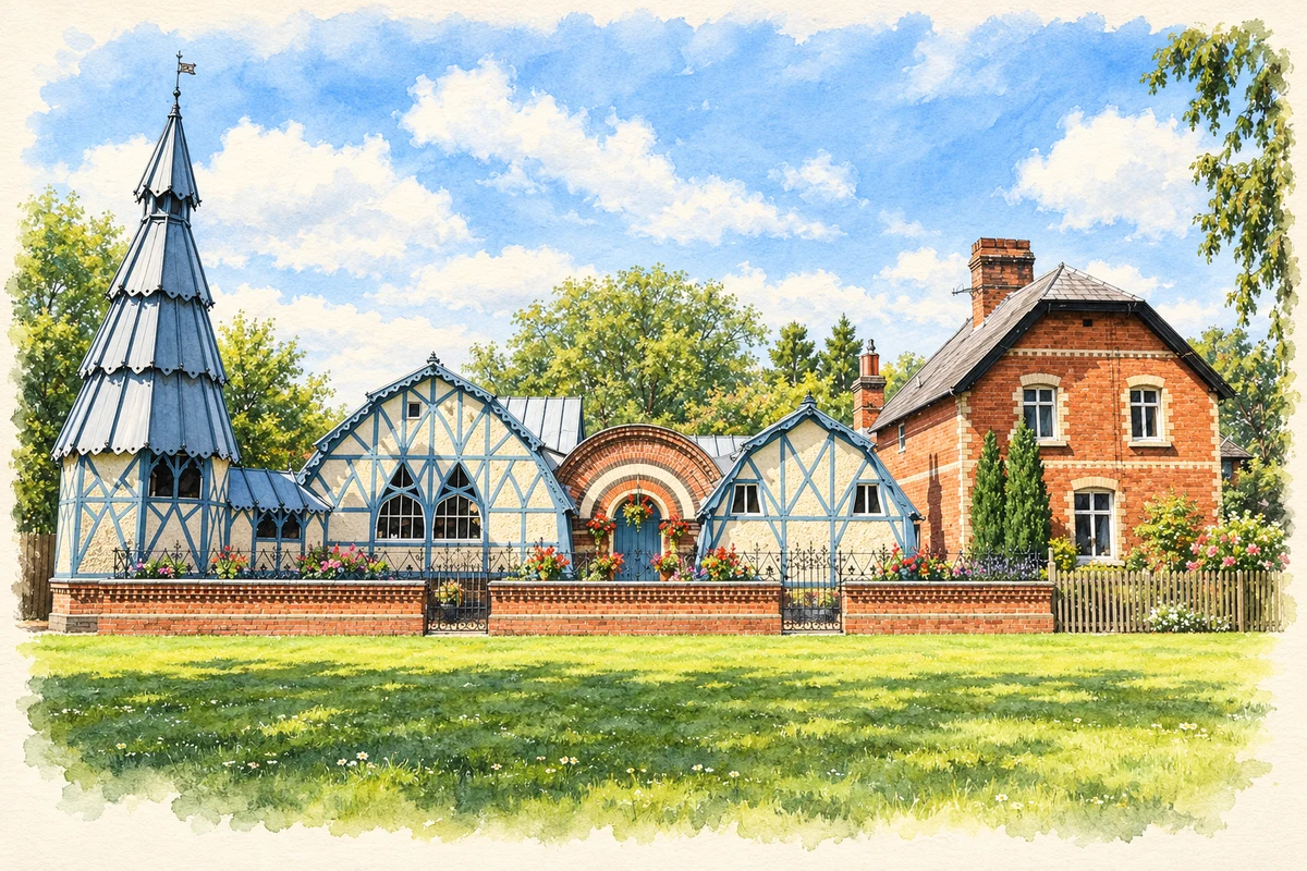
Watercolour and fine ink illustration of Tenbury Wells Pump Rooms
Illustration · Tenbury Wells Pump Rooms
History & heritage

Place & story

A market serving farms and travellers

Tenbury’s market economy grew where local farming met longer journeys. Medieval charters established weekly trading and fairs; by the seventeenth century travellers’ guides placed the town on routes towards Ludlow. Cattle and the surrounding countryside supported butchers, tanners and glovers, while inns and victuallers served people passing through. A small town could sustain several kinds of work because its customers came from beyond its own streets. [3]

An eighteenth-century description published with Thomas Sanders’s views records a Tuesday market and three annual fairs for cattle, horses and sheep. It also tells of a destructive flood in 1770 which brought down parts of the church. The same river setting that helped define the town’s location carried a repeated cost in damaged buildings and disrupted lives. [4]

A new name and a different ambition

In 1839, sinking a well unexpectedly revealed mineral springs. The discovery encouraged development and the adoption of the name Tenbury Wells. The Pump Rooms, designed by James Cranston around 1862, gave that ambition a physical home. Iron framing and sheet-iron cladding stood alongside brick and timber details: the unusual appearance came from a mixture of materials as well as ornamental choices. [2]

The complex brought assembly space, brine baths, an octagonal pump room and a reading room together. It offered sociability and reading as well as bathing. The Town Council describes the 1862 venture as an effort to attract working-class spa visitors. Today it owns and manages the Pump Rooms, holds meetings in the Assembly Room and accommodates the Town Clerk there. A building intended for visitors has acquired a lasting civic role. [2] [5]

A cinema kept for the community

The Regal opened in 1937 after alterations to existing Teme Street premises. Its own history reproduces contemporary newspaper accounts of plans for a cinema behind two shops and an opening-night queue. George Legge’s painted auditorium offered a decorative world within a familiar commercial street; the retained frontage connected a new entertainment business with older premises. [6]

Commercial cinema closed in 1966. In 1970 the Town Council bought the building to safeguard community use; an extended stage helped accommodate live performance. Restoration in 2011–12 recovered murals, lighting and flooring. The Heritage Lottery Fund records an official reopening on 28 July 2012 and identifies mural artist Richard Gill’s conservation work. The venue’s survival depended on civic ownership, volunteers and repair as well as public enthusiasm for films. [7] [11]

Keeping memories and living with water

Tenbury Museum preserves several scales of local experience. Its collections include family papers associated with Henry Hickman, domestic objects and recorded memories in Tenbury Voices. Digitised Tenbury Advertisers cover 1871–1993. In 2012–13, spa fountain and bathing items long displayed in the museum returned to the Pump Rooms, connecting objects with the place where they had been used. [8]

Flooding remains part of the town’s history. The Environment Agency places Tenbury on the floodplain of both the Teme and Kyre Brook, and records extensive inundation in November 2019 and February 2020. Its October 2020 announcement described new funding and consultation for proposed defences. Those were proposals at that date, rather than evidence of a completed protective system. [10]

Back to contents
Lives connected to this place

Notable people

Henry Hill Hickman: a practice and an unfinished investigation

Henry Hill Hickman, born near Ludlow in 1800, spent the closing part of his life practising in Tenbury. He had investigated painless surgery through experiments on animals deprived of oxygen, which he described as suspended animation. The Museum of Anaesthesia explains that the insensibility resulted from asphyxia. His work attracted little support, and after an unsuccessful attempt to interest French doctors he returned to England and established his Tenbury practice. He died in 1830. Tenbury Museum’s family archive preserves the local connection; his story should not be confused with the later routine use of safe surgical anaesthesia. [9] [8]

Back to contents
A chronology

Timeline

Tenbury through time

  1. 1770 — A contemporary town account records flood damage to the church. [4]

  2. 1830 — Henry Hill Hickman dies after practising in Tenbury. [9]

  3. 1839 — A newly sunk well reveals mineral springs. [2]

  4. Around 1862 — Cranston designs the Pump Rooms, baths and reading room. [2]

  5. 1937 — The Regal opens. [7]

  6. 1966–70 — Commercial cinema closes; the council subsequently acquires the Regal. [7]

  7. 2012 — The Regal reopens after restoration. [11]

  8. February 2020 — Severe flooding again affects the town. [10]

Back to contents

Population over time

Built-up area · Settlement · Census 2021

Tenbury Wells

3,935people · 2021

Census 2021 population of the named settlement, using ONS built-up area boundaries.

Published census counts.

Sources: ONS: Towns and cities, characteristics of built-up areas, Census 2021 (Table 1c)

View population figures
Tenbury Wells — census population
Census yearPopulation
20213,935
Sources and how to read this chart

Usual residents on 21 March 2021; published ONS count rounded to the nearest 5.. Boundary geography: December 2022 (E63003231).

Census 2021 population of the named settlement, using ONS built-up area boundaries.

ONS Table 1c rounds counts to the nearest 5 and suppresses counts below 10. Matched by exact settlement name or individually reviewed district-qualified name, with its coordinate strictly inside that same official BUA boundary. The 2022 BUA geography changed methodology and cannot be directly compared with 2011 BUAs. Contains OS data © Crown copyright and database right 2026. Contains National Statistics data © Crown copyright and database right 2026.

Source: ONS: Towns and cities, characteristics of built-up areas, Census 2021 (Table 1c). Open Government Licence v3.0. Retrieved 2026-10-26. Source: ONS and Ordnance Survey: Built Up Areas December 2022 GB BGG. Open Government Licence v3.0. Retrieved 2026-10-26.

Neighbourhood census context

These figures describe statistical neighbourhoods, which may cover part of a place or include neighbouring places.

Neighbourhood census area · 1971–2021

Malvern Hills 001

Population of the area containing the recorded point for Tenbury Wells, not the whole place. This area may cover part of the place or include neighbours.

02.3k4.5k6.8k9k1971: 6,110 people19711981: 6,995 people19811991: 7,200 people19912001: 7,683 people20012011: 7,877 people20112021: 8,420 people2021

Includes harmonised historical census estimates.

Sources: ONS · Paul Norman

View population figures
Malvern Hills 001 — census population and harmonised historical estimates
Census yearPopulation
19716,110
19816,995
19917,200
20017,683
20117,877
20218,420
Sources and how to read this chart

Usual residents of the containing MSOA; this is local area context, not the population of the named settlement.. Boundary geography: 1 April 2022 (E02006710).

2011 and 2021 census counts harmonised by ONS to the same 1 April 2022 geography. Location matched to ONS 2021 MSOA polygons (full resolution, coastline clipped, V7). ONS exact-fit lookup marks this MSOA unchanged from 2011 (U); historical estimates use that same footprint.

1971–2011: Paul Norman harmonised historical estimates on 2011 MSOAs, rounded to whole residents (1971–1991 are modelled). 2021: ONS census count. The historical 2011 total can differ slightly from the ONS change-over-time 2011 total because of methodology and statistical disclosure controls. These are area estimates, not settlement totals.

Source: ONS Census change over time: usual resident population, 2011 and 2021. Open Government Licence v3.0. Retrieved 2026-10-26. Source: ONS MSOA December 2021 boundaries EW BFC V7. Open Government Licence v3.0. Retrieved 2026-10-26. Source: Paul Norman — Area characteristics: Great Britain 1971 to 2011. Creative Commons Attribution 4.0. Retrieved 2026-10-26. Source: ONS MSOA 2011 to MSOA 2021 exact-fit lookup for England and Wales. Open Government Licence v3.0. Retrieved 2026-10-26.

Recorded locationTenbury Wells52.31117° N · 2.59369° WInteractive map loads when this area enters view.
Approximate recorded location · Geographic source

Geographic context

Place type
Town
Country / region
England · West Midlands
County group
Worcestershire
Current administration
Malvern Hills
Current administration
Worcestershire
Recorded coordinates
52.31117, -2.59369
OS Open Names ID
osgb4000000074565801

County groups are browsing aids. Current administrative and historic areas are recorded separately.

Recorded names

  • Tenbury Wells · en · official

Nearby heritage

Distances are from the recorded place point. Proximity does not establish that a site lies within the place boundary or belongs to its history.

Sources & further reading

  1. OS Open Names October 2026 · Source licence.
  2. Pump Room, Brine Baths and Reading Room · Historic England
  3. Tenbury: trade and occupations · Worcestershire Token Project
  4. Tenbury in Thomas Sanders’s Perspective Views · Revolutionary Players / Birmingham Central Library
  5. The Pump Rooms · Tenbury Town Council
  6. Our History · Regal Tenbury Trust
  7. The Regal · Tenbury Town Council
  8. Collections · Tenbury Museum
  9. Henry Hill Hickman (1800–1830) · Association of Anaesthetists / Museum of Anaesthesia
  10. Tenbury Wells flood project starts, consultation open · Environment Agency
  11. Art deco cinema reopens following restoration · National Lottery Heritage Fund
  12. Illustration of Tenbury Wells Pump Rooms, adapted from Pump Rooms, Tenbury Wells - geograph.org.uk - 4581034.jpg by Philip Halling. CC BY-SA 2.0. AI-assisted watercolour and fine ink adaptation; cream paper margins, simplified fine detail and removal of incidental street clutter.

Geographic source retrieved 2026-10-26. History last researched 2026-10-27. How this page was prepared.