Worcester's cathedral city was also a place of industry, medical reform and military conflict. Alongside its medieval books and buildings, the tools of glove workers, the porcelain factories and the Commandery reveal the many kinds of work that shaped it.
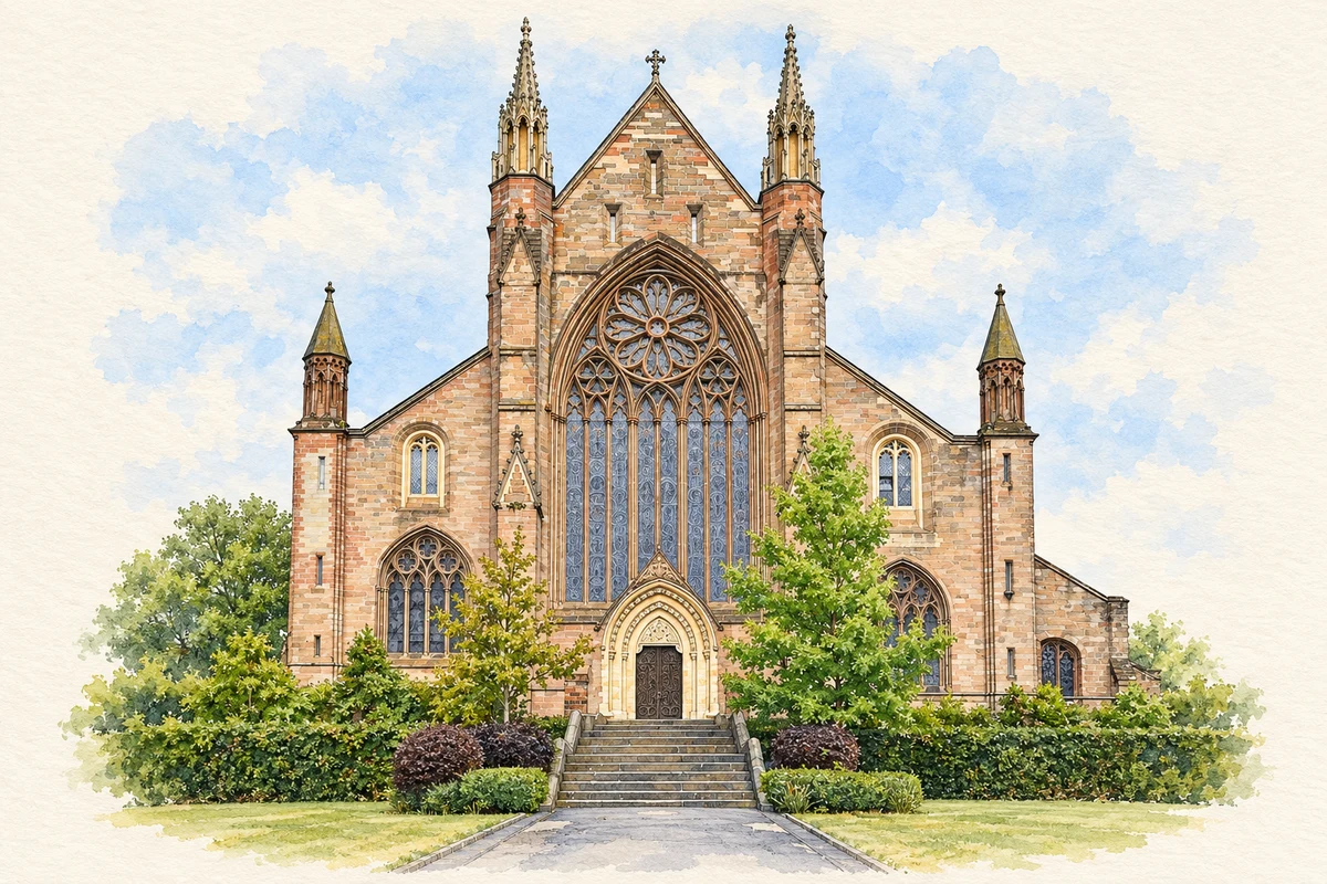
Illustration · Worcester Cathedral
History & heritage
Place & story
A working city before the porcelain factories
Worcester's industrial history extends well before its famous porcelain. The city council identifies an important Roman industrial centre beneath the later town, within an area occupied since prehistoric times. Medieval Worcester acquired stone walls and numerous churches around its cathedral. Its surviving timber-framed and Georgian buildings belong to different phases of that long urban development, rather than to a city built in a single age.[3]
Leather working gives one route into the medieval economy. Tax records from 1356 name dyers, tanners and shoemakers in the All Saints area near the Severn. Tanning created problems as well as employment: records of 1466 describe tanners being banned from the city because of the smell and filth. Archaeological finds of waste horn and bone also identify tanning across the river in St John's. The river landscape held trades that respectable streets might prefer to keep at a distance.[4]
Cathedral, monastery and library
The first cathedral was founded in 680. Oswald built another cathedral and established an attached monastery in 983; Wulfstan began the present building in 1084. Worcester's Benedictine community became a centre of study, with subjects extending from theology to medicine, mathematics and astronomy. Medieval textbooks survive in the cathedral library, preserving evidence of that wider intellectual life alongside the architecture.[2]
The monastery was dissolved in 1540, and some of its last monks became members of the new Dean and Chapter. Later Civil War damage required rebuilding after the Restoration, followed by further campaigns of repair, including major Victorian work in 1864–75. Institutional change, conflict and restoration all helped produce the cathedral seen today; the surviving books connect it with the activities once carried out inside.[2]
The Commandery before and after the battle
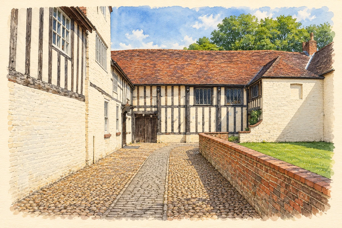
The Commandery began as the Hospital of St Wulstan outside a city gate, serving poor and sick people and travellers. Its earliest surviving buildings are fifteenth-century, although its foundation is older. After the Reformation it became a private house. Substantial timber framing, later brickwork and repeated additions record changes of use within the same complex, rather than an intact hospital plan surviving unaltered.[5][6]
The building became one of the Royalist headquarters during the Battle of Worcester. Fort Royal on the hill behind it formed part of the defences. On 3 September 1651, Oliver Cromwell attacked Charles II's army and, after hours of fighting, Royalist resistance collapsed. Charles escaped, but the defeat ended the remaining Stuart military challenge in Britain. The registered battlefield includes the nearby Powick Bridge skirmish of 23 September 1642, linking the area with both the opening fighting and the final battle of the English Civil Wars.[7][8]
The Commandery continued to work after its military role ended. It was divided into houses, used as a school for blind pupils and later occupied by Littlebury's printing works. It opened as a museum in 1977. These later uses help explain why the building deserves attention beyond a single day's fighting: care, domestic life, education and print all left their place in its history.[6]
Illustration · The Commandery courtyard
Gloves: skill beyond the factory gate
Worcester's leather trades developed into a glove industry with an international reputation. The city museum's collection contains finished gloves, archives and tools from factories and outworkers. That distinction matters. The objects represent work done in dispersed settings as well as large premises, and allow the story to extend from a firm's name to the skills and routines of its workers.[9]
The preparation of leather remained part of the local economy well into the twentieth century. The Severn Bank Tannery and Robert James & Sons were still producing leather around the middle of the century, according to the museum's research. Preserved tools and records allow manufacturing work to be studied alongside the finished gloves.[4][9]
Experiments become porcelain businesses
Worcester porcelain grew from collaboration and investment. Around 1750 the physician John Wall and apothecary William Davis appear to have experimented at Davis's Broad Street shop. The Museum of Royal Worcester cautions that the precise sequence is difficult to establish, but records a lease for Warmstry House beside the Severn on 16 May 1751 and a partnership deed signed by 15 partners on 4 June. A scientific experiment was becoming an organised manufacturing business.[10]
Tea drinking helped create customers for the factory's wares. Its production ranged from blue-and-white tableware to richly gilded and enamelled pieces; some painters remain known only by descriptive nicknames. The museum also records an agreement with the London decorator James Giles in 1767–71, showing that making and decorating could take place in different cities. Finished Worcester porcelain depended on business relationships and skilled hands beyond a single workshop.[10]
The local industry also produced competitors. Robert Chamberlain, formerly head of decorating at Warmstry House, began his own decorating business in King Street in 1783. He initially bought undecorated porcelain from other factories, then made his own wares at Severn Street by the late 1780s. His route from decorator to manufacturer shows why Worcester's porcelain history is a story of several enterprises, rather than one unchanging factory.[11]
A new water route to Birmingham
The Worcester & Birmingham Canal created a shorter connection between Birmingham and the Severn. Authorised in 1791, it opened throughout in 1815 after slow construction and financial difficulty. The original intention was a broad canal, but the section from Tardebigge to Worcester was built for narrow boats. The changing dimensions record a compromise between ambition and available money, while the completed route joined Worcester to the inland industrial network.[12]
The city as a place of medical exchange
Medical institutions added another kind of work to the city. On 19 July 1832 the Worcester Infirmary's board room hosted the first meeting of the Provincial Medical and Surgical Association. Its printed proceedings survive in the Wellcome Collection, including an address by Charles Hastings. The meeting placed Worcester within a wider effort to exchange medical knowledge and organise the profession; the association subsequently developed into the British Medical Association.[13][14]
John Wall was born at Powick, near Worcester, in 1708, rather than in the city itself. He attended the King's School and returned to practise in Worcester in 1740. Alongside his porcelain experiments, he helped establish the charitable Silver Street hospital, which opened in 1746, and pursued painting. His career connects the city's manufacturing, medical and artistic life through a specific resident whose interests crossed those boundaries.[15]
Charles Hastings: the infirmary and public health
Hastings was appointed house surgeon at Worcester Infirmary at eighteen, studied medicine at Edinburgh and returned as a physician. He pressed for additional beds and better living conditions as the city faced epidemics. His interests also included natural history and the development of Worcester's museum. A cathedral memorial window commemorates a local working life that linked treatment of individual patients with the improvement of institutions and public knowledge.[14]
Edward Elgar: childhood above a music shop
Elgar's birthplace was the Firs at Broadheath, outside Worcester, but much of his childhood belonged to the city. His family lived in Edgar Street and College Precincts before moving above the family music business at 10 High Street. His father William Henry worked as a piano tuner and music seller. The household's connection to instruments and scores gives the composer a precise urban setting alongside his better-known association with the surrounding countryside.[16][17]
Worcester 007 — census population and harmonised historical estimates
Census year
Population
1971
5,441
1981
5,488
1991
5,783
2001
5,898
2011
6,979
2021
7,337
Sources and how to read this chart
Usual residents of the containing MSOA; this is local area context, not the population of the named settlement.. Boundary geography: 1 April 2022 (E02006740).
2011 and 2021 census counts harmonised by ONS to the same 1 April 2022 geography. Location matched to ONS 2021 MSOA polygons (full resolution, coastline clipped, V7). ONS exact-fit lookup marks this MSOA unchanged from 2011 (U); historical estimates use that same footprint.
1971–2011: Paul Norman harmonised historical estimates on 2011 MSOAs, rounded to whole residents (1971–1991 are modelled). 2021: ONS census count. The historical 2011 total can differ slightly from the ONS change-over-time 2011 total because of methodology and statistical disclosure controls. These are area estimates, not settlement totals.
Illustration of Worcester Cathedral, adapted from Worcester Cathedral west front.jpg by Kognos. CC BY-SA 4.0. AI-assisted watercolour and fine ink adaptation; cream paper margins, simplified fine detail and removal of incidental street clutter.
Illustration of The Commandery courtyard, Worcester, adapted from The Commandery, Worcester, 25 May 2019 by Philip Halling. CC BY-SA 2.0. AI-assisted watercolour and fine ink adaptation; incidental bunting and ribbons removed, cobbles and fine textures simplified. Adaptation shared under CC BY-SA 2.0.
 place